
Bird Migration in New Mexico
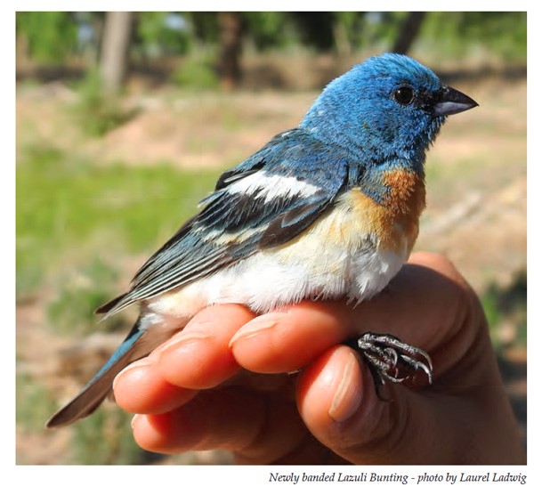
- Overview of migration in New Mexico in English p. 350-355
- Interesting Facts About Bird Migration p. 356
- Selected Bosque Bird Information Cards p. 357- 361: Greater Roadrunner, Black-chinned Hummingbird, Sandhill Crane, Wilson’s Warbler, Yellow-billed Cuckoo, White-crowned Sparrow, Chipping Sparrow.
- List of Migratory Birds Frequently Found in New Mexico p. 363
- Activity 47. Who Flew Where? p. 364-378.
- Students explore bird migration using actual banded bird recovery data; students measure a scaled distance of where 20 different birds were found from where they were originally banded. A second part has students locating those places on a map of western North America.
- Recapture species cards. English cards p. 372-376
- North America Banding Recapture Maps. Choose with stars (easier) or without stars marking the locations, where students must use latitude and longitude for placement. Maps include Spanish & English on each map. We recommend printing on 11 x 17 paper. p. 377-378
- Activity 48. Changes in Bird Populations PDF p. 379-383.
- Students graph long-term data of birds banded by Rio Grande Bird Research to see if there have been changes in the birds encountered.
- Glossary of migration terms p. 384-385
- Standards p. 386-387
Video documenting a morning with volunteer bird banders in the Bosque by Valle de Oro National Wildlife Refuge. (2 min 11 seconds)
- Migración de aves en Nuevo México p. 577-582
- Datos interesantes sobre la migración de aves p. 583
- Tarjetas de información sobre las aves del bosque p. 585-589. Correcaminos norteño, Colibrí garganta morada, Grulla de Sandhill, Chipe de corona negra, Cuco de pico amarillo, Gorrión de corona blanca, Gorrión ceja blanca
- Aves migratorias frecuentemente observadas en Nuevo México p. 591
- Actividad 47. ¿Quién voló a dónde? p. 593-601
- Los estudiantes exploran la migración de aves usando datos reales de aves anilladas y recapturadas; los estudiantes miden la distancia (a escala) del lugar donde encontraron 20 diferentes aves con respecto al lugar donde fueron anilladas. En la segunda parte, los estudiantes localizan estos lugares en un mapa del oeste de América del Norte.
- Recuperar las cartas de especies. El archivo incluye ambos inglés p. 1-5 y español p. 6-10.
- Mapas de recaptura de bandas en América del Norte. Elegir con estrellas (más fácil) o sin estrellas o sin estrellas marcando las ubicaciones. Usa la latitud y la longitud para encontrar la ubicación. Recomendamos imprimir en papel de 11 x 17.
- Actividad 48. Cambios en las poblaciones de aves p. 602-607
- Los estudiantes hacen gráficos de datos de largo tiempo de aves anilladas por Rio Grande Bird Research para ver si hay cambios en las aves encontradas.
- Vocabulario/Glosario sobre la migración de aves p. 608
Energy in Bosque Ecosystems
Students follow the path of energy through the bosque ecosystem. In either a small group presentation or as a poster, teams of students use appropriate vocabulary to illustrate energy gained and lost through a short food chain, from a plant to an herbivore to a carnivore.
PDF Activities
Agriculture
Acequia Culture Background Essay
Birds
- Naturalist Notebook (PDF)
- Who Lives Where? (PDF)
- Mapping Species Richness (PDF)
- Crane Migration (PDF)
Bosque Field Trip Activities PDF Links
- Naturalist Notebook (PDF)
- Wildlife Detectives (PDF)
- Crawly Creatures (PDF)
- Dip-Net Critters (PDF)
- A Rose By Any Other Name (PDF)
- Reading the Bosque (PDF)
- Winter Buds Activity (PDF)
Service Learning
Cottonwood Trees
Middle Rio Grande Bosque (Background Essay)
- Naturalist Notebooks (PDF)
- Reading the Bosque (PDF)
- Winter Bud Activity (PDF)
- Changing River (PDF)
- Cottonwood Creations (PDF)
Fire in the Bosque (Background Essay)
Ecology
- Changing River (PDF)
- Who Lives Where? (PDF)
- Who Grows Where? (PDF)
- Bosque Chaos (PDF)
- The Web (PDF)
- Mapping Species Richness (PDF)
Fire in the Bosque (Background Essay)
Fire
Fire in the Bosque (Background Essay)
- Fire Vocabulary Match-up (PDF)
- Spectrum of Fires (PDF)
- Post-fire Survival of Bosque Trees (PDF)
- Naturalist Notebooks: Fire (PDF)
- Changing Fire (PDF)
Geography
Geology
Geologic History of the Rio Grande Rift (Background Information)
- Timeline Activity (PDF)
- What is the Rio Grande Rift? (PDF)
- Porosity and Permeability (PDF)
- Rio Grande Stream Table (PDF)
Graphing
- Crane Migration (PDF)
- How Deep is the Water Table? (PDF)
- Interpreting a Hydrograph (PDF)
- Change is All Around Us (PDF)
- Post-fire Survival of Bosque Trees (PDF)
Human History
Acequia Culture (Background Essay)
Insects
- Field Exploration Booklet (PDF)
- Crawly Creatures (PDF)
- Dip-net Critters (PDF)
- Reading the Bosque (PDF)
Internet Skills
- WebQuest: Invasive Species (PDF)
- WebQuest: Geological History (PDF)
- How Deep is the Water Table? (PDF)
- Interpreting a Hydrograph (PDF)
Journaling
Kinesthetic Activities
Mapping
- Mapping Species Richness (PDF)
- Surface Water Demonstration (PDF)
- Watersheds in New Mexico (PDF)
- Change is All Around Us (PDF)
Plants
- Naturalist Notebooks (PDF)
- A Rose By Any Other Name (PDF)
- Reading the Bosque (PDF)
- Winter Bud Activity (PDF)
- Changing River (PDF)
- Cottonwood Creation (PDF)
- Who Grows Where? (PDF)
- The Web (PDF)
- WebQuest: Invasive Species (PDF)
Fire in the Bosque (Background Essay)
Reading
Geologic History of the Rio Grande Rift (Background)
Schoolyard Activities
- Wildlife Detectives (PDF)
- Crawly Creatures (PDF)
- Winter Bud Activity (PDF)
- Crane Migration (PDF)
- Rio Grande Bosque Water Cycle (PDF)
- Surface Water Demonstration (PDF)
- Rio Grande Stream Table (PDF)
Trees
- Naturalist Notebooks (PDF)
- Reading the Bosque (PDF)
- Winter Buds Activity (PDF)
- Cottonwood Creation (PDF)
- Bosque Chaos (PDF)
- A Spectrum of Fires (PDF)
- Post-fire Survival (PDF)
- Naturalist Notebooks: Fire (PDF)
Upper Watershed / Statewide Perspective
- Changing River (PDF)
- Who Lives Where? (PDF)
- Mapping Species Richness (PDF)
- Rio Grande Bosque Water Cycle (PDF)
- Surface Water Demonstration (PDF)
- Watersheds in New Mexico (PDF)
- A Spectrum of Fires (PDF)
Water
- Dip-net Critters (PDF)
- Changing River (PDF)
- Working Water (PDF)
- Bosque Chaos (PDF)
- What is the Rio Grande Rift? (PDF)
- Porosity and Permeability (PDF)
- Rio Grande Bosque Water Cycle (PDF)
- Surface Water Demonstration (PDF)
- Watersheds in New Mexico (PDF)
- Rio Grande Stream Table (PDF)
- How Deep is the Water Table? (PDF)
- Water Budget Activity (PDF)
- Interpreting a Hydrograph (PDF)
Wildlife
- Naturalist Notebooks (PDF)
- Wildlife Detectives (PDF)
- Reading the Bosque (PDF)
- Who Lives Where? (PDF)
The Web
Enlaces de Actividades del Bosque
Forward and Resources
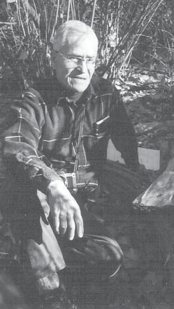
The Bosque Education Guide is dedicated to Clifford Crawford, professor emeritus of biology at the University of New Mexico, long-time bosque researcher, co-author of Middle Rio Grande Ecosystem: Bosque Biological Management Plan, director of the Bosque Ecosystem Monitoring Program, key supporter of the Bosque Improvement Group, and treasured mentor and colleague.
Foreword
By Cynthia G. Abeyta, Middle Rio Grande Coordinator/Hydrologist, U.S. Fish and Wildlife Service
The Rio Grande bosque (riparian forest) is a priceless resource that stretches alongside the majestic Rio Grande. As the Rio Grande experiences significant changes due to natural and anthropogenic activities, so does the bosque.
Understanding the effects of these dynamic processes is necessary in sustaining a quality environment for all beings that live in, adjacent to, or at a distance from the Rio Grande. The vulnerability of the Rio Grande and the Bosque to over-use and development, degradation, fuel loading, encroachment of invasive species, etc., is a major concern to many.
The principal objective of this guide is to provide an exciting hands-on environmental education program for teachers (K–12) so that current and future generations will be equipped with a better technical understanding of the dynamic processes that occur in the Rio Grande and its bosque. Today's students are the resource managers of the future. Information provided in this guide makes learning and teaching about our environment and natural resources fun. The hands-on activities provide educators and students opportunities to experience and appreciate one of our country's most remarkable natural resources, the Rio Grande and its bosque, a resource many of us take for granted.
The proven success of the first edition of the Bosque Education Guide (published in 1995) has resulted in continued support from the Middle Rio Grande Bosque Initiative for production of its second edition. The Middle Rio Grande Bosque Initiative is an ongoing, congressionally supported interagency ecosystem management effort with the objective of protecting, enhancing, and restoring biological values by addressing ecological functions within the Middle Rio Grande. The Middle Rio Grande Bosque Initiative is guided by the Bosque Improvement Group (BIG). BIG is an informal, non-exclusive "think tank" that provides a forum for those interested in the Rio Grande and its bosque. BIG participants include federal, tribal, state, city, county, and local government agencies, educational institutions, private industry, non-profit organizations, and private individuals.
The Middle Rio Grande Bosque Initiative and BIG are grateful to Bosque Education Guide project coordinators Mary Stuever, Letitia Morris, Rebecca Tydings, and Lisa Ellis, the many others who have contributed to the production of the guide, and the educators and students who have utilized this valuable educational program. We are confident this new edition of the guide will continue to equip current and future generations with a solid foundation for better understanding, appreciating, and protecting this vital natural resource, the Rio Grande and its bosque.
Chapter 1: Introduction
This guide does more than offer guidance; we hope it also offers knowledge, ideas, and passion about a special ecosystem found along the rivers of New Mexico. Our focus in particular is on an approximately 200-mile stretch of forests and woodlands growing directly adjacent to the Rio Grande in central New Mexico. We call this forest the Middle Rio Grande bosque. We call this book the Bosque Education Guide.
This guide does not stand alone. Workshops, kits, web pages, handouts on access and organizational contacts, and newsletters are some of the additional tools designed to help New Mexico educators teach about the bosque. We expect this guide to be used in as many different ways as there are teachers who pick it up. However, we provide a recommended approach for using this guide, as well as ideas for inquiry-based learning.
We also hope this chapter answers the question of why you may want to use this guide or, more accurately, why you might want to use the Bosque as a focal point in your teaching. We have taken two approaches to addressing this question. First, we have provided some history on this guide and some background on how and why it was developed. In addition, we have appealed to several teachers who regularly use the Bosque as an outdoor learning environment to share their thoughts about teaching in the Bosque. In the next section of this chapter, you will find their essays, presented as inspiration for your own teaching and writing.
Whether you have been teaching about the bosque for years or this is the first time you have heard of this ecosystem, we hope you will find this guide a worthwhile companion in your efforts to connect more students to the natural world around them.
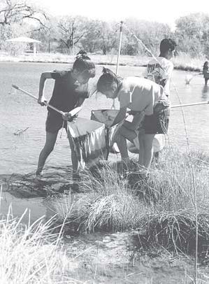
About This Guide
The first edition of the Bosque Education Guide was published in 1995. The guide takes an interdisciplinary approach and includes activities that are both field-based and classroom-based. In the first seven years, over 600 educators attended workshops on how to use this guide and received the first edition of the guide and kit.
This second edition of the guide represents major revisions. The guide, originally targeted for students in third to fifth grade, has been expanded to include activities for students from kindergarten through high school. Actually, we find that some activities in the guide have been applied in college classrooms and adult programs as well.
The guide has been broadened. New activities have been added that teach about geology, agriculture, culture, and plants. We have expanded and updated the background information, offered adaptations for bosque ecosystems outside of the Middle Rio Grande Valley, and referenced the activities in this guide to relevant New Mexico Department of Education standards (K–12, all disciplines).
The major change offered by this second edition is the addition of ecosystem restoration to our understanding of the river system. In the first edition, we presented the river as two different ecosystems. The old river (we called Rio Grande Viejo) represented how the river functioned before major human-influenced changes (dams, diversions, waterflow management, exotic species introductions, etc). The new river (we called Rio Grande Nuevo) represented how the river was altered by human activities. In this guide, we model three river systems: the wild river, or Rio Bravo (akin to the old river in the old guide); the tame river, or Rio Manso (akin to the new river in the old guide); and the new river, or Rio Nuevo, which represents what the river ecosystems can be like when people care and act for the river.
Downloads
Chapter 2: Bosque Background
The Middle Rio Grande River Valley
By Lisa Ellis, Ph.D.
Department of Biology, University of New Mexico
The cottonwood forest that borders the Rio Grande in central New Mexico is a remnant of a unique and diminishing habitat. Known locally as the bosque (pronounced boh-skay), a Spanish word for "forest," these riparian, or riverside, forests provide valuable resources for animals and plants living in the arid Southwest. Unfortunately, the Rio Grande and its bosque have been heavily altered by human activities, especially during the last century. Regulation of water flow in the river has not only impacted the organisms that live in the water, but has also changed the mosaic of vegetation types once present in the valley. Wetlands, once common in the floodplain, have been greatly reduced and the cottonwood forests are dying out. Non-native plants and animals have spread throughout the valley, often displacing the native species; without changes in current water management practices, non-native trees and shrubs will soon dominate the bosque.
Fortunately, many citizens of the valley recognize the ecological, cultural and aesthetic values of the bosque and surrounding wetlands. Active restoration of native habitats is underway and local people are joining together to save the forests that remain. With our help, the bosque has a future. The first step to help the bosque is to learn its ways, to understand the complexity of this ecological system and to share this knowledge with others. This brief introduction provides you, the educator, with background information to support the activities that follow.
The Middle Rio Grande Valley
The state of New Mexico contains three distinct river systems: the Rio Grande, the Canadian River, which eventually drains into the Mississippi, and the San Juan and Gila rivers, which both drain into the Colorado. A fifth major river, the Pecos, drains into the Rio Grande in Texas and so is considered part of that system. Numerous smaller rivers and creeks all drain into one of these systems, or in a few cases into closed basins with no outflow. The Rio Grande is the dominant river system in New Mexico in terms of the area of its watershed, or the area of land from which water drains into the river (see The Upper Watershed section below for a more thorough explanation of watersheds).
In total, the Rio Grande stretches about 2,000 miles (3,220 km) from its headwaters along the Continental Divide in the San Juan Mountains of southwestern Colorado to its outflow into the Gulf of Mexico near Brownsville, Texas, and Matamoros, Mexico. Along the way, the Rio Grande passes through three states in the United States (Colorado, New Mexico, Texas) and four in the Republic of Mexico (Chihuahua, Coahuila, Nuevo Leon, Tamaulipas). The Rio Grande, known as the Rio Bravo in Mexico, forms the international boundary between Texas and Mexico. In this guide we focus on what is known locally as the Middle Rio Grande Valley.
This name is a bit misleading, for it does not represent the actual "middle" of the river, but rather refers to the approximate middle of the portion of the river that passes through New Mexico. This is typically defined as extending from Cochiti Dam, north of Albuquerque, downstream 160 river miles (260 km) to San Marcial, New Mexico. The Middle Rio Grande represents approximately a third of the river's length through New Mexico, but only 8% of the river's total length. The Middle Rio Grande watershed in turn represents about 14% of the whole Rio Grande drainage basin, or 24,760 mi² (64,150 km²). The major tributaries along the Middle Rio Grande are (from north to south) Galisteo Creek, Jemez River, Rio Puerco and Rio Salado.
The Middle Rio Grande Valley includes four New Mexico counties (Sandoval, Bernalillo, Valencia and Socorro) and six Indian pueblos (Cochiti, Santo Domingo, San Felipe, Santa Ana, Sandia and Isleta). Other principal land and facility managers include the Middle Rio Grande Conservancy District, Bureau of Reclamation, Army Corps of Engineers, New Mexico Department of Game and Fish, U.S. Fish and Wildlife Service, New Mexico State Parks, the City of Albuquerque Parks and Recreation Division, and private landowners.
The dominant geographic feature in the Middle Rio Grande Valley is the Rio Grande Rift, which extends more than 500 miles (800 km) from central Colorado through New Mexico. A rift occurs when two sides of a fault zone pull away from each other, leaving a large, trench-like valley. The crust beneath the rift has been stretched and thinned by extensional fault movements. The valley is actually a series of basins, each slightly lower in elevation as you move south (thus to call it a single rift is not quite correct, as that implies a single trough, but it is typically referred to this way). Each of these basins once contained its own ephemeral (seasonal) lake. Over time water eroded the canyons between basins, eventually merging into the continuous river. The term "valley" is thus also not technically correct, because a valley is carved by a river that cuts through the bedrock rather than taking advantage of a trough that was already there, but this is another term that is accepted as correct and so will be used here. The Rio Grande Rift has been geologically active for about the last 20 million years while the Rio Grande itself has flowed in its current location through the valley for 1–2 million years. A more detailed geologic history is given in Chapter 5, Geologic History of the Rio Grande Valley.
The climate of the region has been arid to semi-arid over the past 5,000 years, although cyclical drought/wet-year patterns have occurred during this period. These cycles are influenced by the El Niño/La Niña phenomenon, which is caused by periods of variation in water temperatures and barometric pressures in the eastern Pacific Ocean. During El Niño years, New Mexico experiences higher than average winter precipitation, resulting in high spring flows in the Rio Grande, as well as in the Pecos and Gila rivers. In contrast, La Niña years result in drought conditions here in the valley and low water levels in the river.
Rio Grande Cottonwoods
Riparian forests of the Middle Rio Grande Valley are typically composed of Rio Grande cottonwoods (Populus deltoides subsp. wislizenii), a subspecies of the plains (prairie) cottonwood (Populus deltoides). There has been some confusion in the scientific literature as to the specific identity of Rio Grande cottonwoods, but shoot, bud and capsule characters align this subspecies with the eastern Populus deltoides rather than with Fremont cottonwoods (Populus fremontii) as often stated. The center of the distribution of Rio Grande cottonwoods lies along the upper Rio Grande drainage, particularly through the Middle Rio Grande Valley. The species occurs along the Rio Grande from about El Paso northward and probably into the Colorado River drainage of northeastern Arizona, eastern Utah and western Colorado, though Fremont cottonwoods are present in the Colorado River drainage as well. Generally in New Mexico, cottonwoods west of the Rio Grande are Fremont cottonwoods (such as in the Gila and San Francisco watersheds) while those to the east are plains cottonwoods. However, there is considerable hybridization among cottonwoods, and there remains some question as to definite boundaries among species and subspecies. Fortunately, the ecology of these floodplain species is similar, so that knowing whether a tree belongs to P. deltoides or P. fremontii is relatively unimportant in the context of this guide.
Cottonwoods grow well only where their roots can reach moisture provided by underground water and where their seeds can germinate on bare, moist soil. Thus, they are limited to areas with permanent water supplies. Although once widespread throughout low-elevation floodplains, many cottonwood forests have been cleared for farming, river control projects and urban development. The only extensive tracts of Rio Grande cottonwoods remaining are found along the Rio Grande in central New Mexico, from approximately Española south to the Belen area. Unfortunately, these areas also face intensive impact by humans, severely threatening these unique and valuable habitats.
Rio Grande cottonwoods have thick and fissured gray bark and heart- or triangular-shaped leaves. They can reach approximately three feet (one meter) in diameter and 90 feet (30 meters) tall, but their size depends largely on water availability and so it is difficult to age a tree based on size alone. Male and female flowers occur on separate individuals, and small cottonwoods (whether young or just water stressed) typically do not produce any flowers at all. In the spring, male trees bear flowers in long red clusters called catkins. The pollen produced by male flowers is carried by the wind to female flowers on adjacent trees, which are borne in long, greenish clusters. If pollinated, the female flowers develop into capsules containing tiny seeds with cottony plumes. Female trees can produce thousands of these tiny seeds, which are easily dispersed long distances by wind or water. Seeds are produced during a brief period in late spring/early summer, which, prior to river regulation, corresponded to the peak of river flows when the river often flooded over its banks. To germinate, cottonwood seeds require scoured sand bars, which provide bare soil, moisture and plenty of sunlight. Many of the seeds land in unsuitable places, and will fail to develop. Those lucky enough to land on moist, open soil quickly develop roots, and if the post-flood soil moisture does not decrease too rapidly, the roots will soon reach down to the capillary bed above the water table. The water table is the upper surface of saturated ground water, while the capillary bed is a zone of soil above the saturated zone that consists of small spaces containing moisture held by capillary action. The ability of plants to use underground water is important in a region of irregular surface water, and cottonwoods cannot survive where the water table is too deep. Plants such as cottonwoods that can tap their roots directly into the ground water are called phreatophytes.
A Dynamic System
Prior to measurable human influence in the 14th century, the Rio Grande probably flowed year-round, as a meandering, sinuous, braided stream. That is, rather than being confined to a single channel as it is today, the location of the river moved within the floodplain. Most unregulated streams form a series of smooth, loop-like bends called meanders. These meanders occur in channels with low gradient slopes because energy generated from flowing water spreads out as evenly as possible along its course. The location of the meander, and thus of the river, shifts when swift currents erode the outer bank of a meander bend and slow water deposits sediment on the inner side of the meander. Over time, the river will shift and move considerably in this way. Sometimes an entire loop is cut off from the rest of the river as the river tries to take the shortest route, forming an oxbow. This area remains wet, like a small pond or marsh, for some time and then slowly dries out, resulting in changing plant communities. The river was also once more braided than it is now. A braided river consists of two or more interconnected channels separated by sand bars or islands. An active river may flow in only a portion of the braided channels at a given time, but during a single season may shift and move across most or all of the channel system. Occasionally the location of the river channel shifts abruptly on the broad floodplain as major floods cut new channels and drop sediment to block off old ones.
Because of the dynamic nature of the river, the Middle Rio Grande Valley would have continuously supported a patchwork of plant communities. Clearly all such communities, including the cottonwood forest, depend on the stream movement for their existence. Sand bars formed by the shifting river provide the conditions needed for cottonwood establishment. Seedlings that germinate on a newly scoured sand bar produce a cohort of plants of the same age, and if these survive future periods of high water, they will grow into a stand of young trees of about the same size. New seedlings cannot grow in a forest with a closed canopy, which prevents adequate sunlight from reaching the floor, but as the river shifts its course, it may knock out a section of mature forest, thus providing the space needed for the establishment of new stands. The result is a variety of patches ranging from newly established seedlings to old, mature stands of huge trees to open areas with few trees. Such a patchwork of vegetation types is termed a mosaic. In addition to the more catastrophic effects of large floods, the bosque once benefited from the effects of annual inundation (the flood pulse) as the river overflowed its banks during the high spring runoff. Such low-intensity flooding provided water and nutrient-laden sediment to the forest. It also influenced a variety of processes, such as the rate at which nutrients cycle through the system, and limited the accumulation of leaf litter and woody debris on the forest floor.
Historically, these forest patches were interspersed with wetland areas. A wetland is a transitional zone between terrestrial (land) and aquatic (water) systems, where the water table is at or near the surface, or where land is covered by water at least part of the year. Wetlands in the Middle Rio Grande Valley included wet meadows, marshes, sloughs, ponds and small lakes. In combination, these wetland areas were probably a significant component of the floodplain ecosystem, greatly affecting the vegetation and animals present. They were formed partly by the meandering nature of the river and partly by the high water table in the valley; in some areas the water table was actually at the surface, supporting water-loving plants. The resulting mosaic of vegetation types, consisting of patches of cottonwood forest of different ages mixed with various wetland communities and open areas of low terrestrial vegetation, in turn supported a large diversity of organisms. As a consequence, the Middle Rio Grande Valley had an extremely rich assortment of plant and animal life.
Plants and Animals of the Middle Rio Grande Valley
The river and its floodplain support a variety of plants and animals. In addition to the Rio Grande cottonwoods, native woody plants along the Middle Rio Grande include Goodding and peachleaf willows (Salix gooddingii and Salix amygdaloides), New Mexico olive (Forestiera neomexicana), coyote willow (Salix exigua), false indigo (Amorpha fruticosa), Anderson wolfberry (Lycium andersonii), seepwillow (Baccharis glutinosa) and others. Various species of grasses, forbs and aquatic plants were once present.
New Mexico, as a state, supports one of North America's most diversified faunas, resulting from its diversity of landforms, elevation, vegetation and climatic history. This was likely reflected in a wealth of animal species in the Middle Rio Grande Valley, although no documented descriptions exist of aquatic or terrestrial animals prior to the arrival of Europeans. Most of the terrestrial animal species that currently use the valley were present before the arrival of Coronado in 1540. Others, including the jaguar, gray wolf and grizzly, were occasional visitors to the riparian corridor.
Throughout the arid Southwest, riparian areas support a greater number and variety of vertebrate species than surrounding uplands. Amphibians require aquatic habitats for at least part of their life cycles, thus conditions in the valley were once ideal for these animals. At least nine species of native amphibians, including many reptiles, use the bosque. The Middle Rio Grande Valley supports at least three turtle species, nine lizard species and 13 snake species. Early documentation of birds suggests a great variety of species present, as both permanent residents and seasonal visitors.
One recent study revealed over 270 species of birds in Rio Grande riparian habitats; 85 to 95 of these species were probably breeding in the valley. There are over 60 species of mammals in the bosque, most of which are rodents; 11 species of bats use the valley. In addition, although often overlooked and poorly studied, the terrestrial invertebrates (isopods, spiders, insects, etc.) of the Middle Rio Grande Valley far exceed the vertebrates in numbers of species and individuals. The river itself historically supported between 17 and 27 species of native fish, as well as a huge variety of aquatic invertebrates. Faunal and floral species lists are provided in Appendix F and G, respectively.
The Upper Watershed
The term watershed is often used when discussing river systems. The meaning of this term has changed somewhat from its original definition, particularly in the U.S. Originally, the term "watershed" referred to the boundary between catchments or drainage basins. That is, watershed referred to an area or ridge of land that separates waters flowing into different rivers, basins, or seas. Over the years, U.S. scientists used the term watershed interchangeably with "drainage basin," so that now another accepted definition for watershed is an area or region drained by a river, river system, or other body of water; this is also the definition of drainage basin. We will use this latter definition, since this permeates the literature that teachers are likely to encounter. A watershed can be viewed at many different scales. A small arroyo has a watershed, which is the area that drains water into that arroyo, while this same area will also be part of a larger watershed that includes all the area that feeds the stream into which the arroyo drains, and likewise in a watershed for the larger river into which the stream drains. In this way, the watershed of a large river may contain thousands of smaller watersheds. It is important to remember that the watershed of a large river, such as the Rio Grande, extends far inland and up into the mountains. In fact, all land on Earth is part of some watershed, since water from any point of land eventually drains into a river system or a sea (or in some cases into a closed basin with no outflow). The watershed for the Rio Grande includes the three U.S. states that the river crosses (Colorado, New Mexico and Texas), while in Mexico, the watershed includes five states (Chihuahua, Coahuila, Nuevo Leon, Tamaulipas and Durango) even though the river only passes through four of these states (all but Durango). Thus people, as well as plants and non-human animals, over a vast area are connected by this common watershed that supports the Rio Grande. We do not have to live immediately next to the river to affect it—actions taken far inland can have significant impacts as well.
Most of our discussion in this guide focuses on the main stem of the Rio Grande in central New Mexico, which is a floodplain river. The upper reaches of the Rio Grande and its tributaries (all of which we will call "upper reaches" here for simplicity) differ in many ways from the Middle Rio Grande, both in the physical characteristics of the streams and in the species of plants and animals present. Because upper reaches each collect water from much smaller areas than the Middle Rio Grande, they contain much less water and thus are narrower. They tend naturally to be more contained within a narrow channel, and thus fairly straight, rather than meandering across a floodplain as does the lower river. Although smaller in size than floodplain rivers, these upper-reach streams tend to have faster flowing water, with alternating riffle (rapids) and pool sections. The streambed tends to include boulders and coarse cobble, rather than the finer gravel, sand or clay substrates seen in larger rivers. The water is generally cold and with few suspended sediments, thus providing a home for coldwater fish including various species of trout, as well as insects such as caddisfly larvae. Typically the riparian vegetation along an upper reach stream forms a very narrow band, including species such as narrowleaf cottonwood (Populus angustifolia), black willow (Salix scouleriana), thinleaf alder (Alnus tenuifolia), boxelder (Acer negundo) and red-osier dogwood (Cornus stolonifera). Although there is considerable overlap among birds that use lowland and upper-reach riparian areas, some, such as the American dipper, are unique to these fast water systems. The proximity of these streams to mountain habitats means that some different species of mammals, such as elk and black bear, are typical here.
Human Use of the River and Bosque
Humans first arrived in what is now known as the Middle Rio Grande Valley 11,000 to 15,000 years ago, toward the end of the last ice age. Early inhabitants were hunters and gatherers, first hunting the now-extinct large mammals such as mammoths, tapirs and sloths and then modern animals. These early people moved up and down the valley and across the surrounding grasslands and foothills in search of food and other resources. Their low population densities and nomadic nature had minimal impact on the bosque. After agriculture was introduced to the valley around AD 400, people became sedentary and villages increased in size. Settlements concentrated along the river, which provided adequate water for their crops. These first farmers were the Ancestral Puebloans (formerly called Anasazi), whose descendants the Spanish later named the Pueblo Indians. The Ancestral Puebloans practiced floodwater farming, utilizing natural overbank flooding to irrigate drought-tolerant crops, rather than installing diversion structures. Hunting and gathering were still important to their subsistence, and impacts on the river and its bosque were minimal. An era of great population increase and development began in the Middle Rio Grande Valley around AD 1350.
The first Europeans, led by Don Francisco Vasquez de Coronado, entered the middle valley in 1540. At that time, an estimated 25,000 acres (10,000 ha) of land were being farmed. Cornfields intermingled with patches of cottonwood trees and 12 pueblos were established near present-day Albuquerque. Human influence on the Middle Rio Grande Valley increased considerably following the Spanish colonization, beginning in 1598. The Spanish introduced irrigation agriculture to the Pueblo Indians, which allowed the import of crops such as wheat and lettuce. During this period, more extensive riparian areas were cleared and water was diverted for agriculture, and canals and acequias (irrigation ditches) were developed to bring water to the fields. By 1700, over 70,000 acres (28,000 ha) of land were being irrigated, and this increased to over 100,000 acres (40,000 ha) by 1800. By about 1850, valley communities were generally established in their present locations. The late 1800s saw an influx of Anglo-Americans into the Rio Grande Basin, with increasing conversion of land to agriculture; a peak of about 125,000 acres (50,000 ha) irrigated for crops was reached in the middle valley in about 1880. A more detailed discussion of acequias and early agriculture in the region is given in "Acequia Culture" in Chapter 5 and in Appendix D: Human Chronology.
The rapid settlement of the Rio Grande Valley from the early 1800s to the present resulted in significant impacts on the aquatic and riparian ecosystems. Sediments eroded from adjacent upland areas as a result of overgrazing and deforestation were deposited in the river, causing riverbed aggradation (a rising riverbed relative to the surrounding floodplain). That, in turn, raised floodplain water table levels. The result was waterlogged soils of high salinity, which negatively affected cultivation; by 1926 only about 45,000 acres (18,200 ha) were being irrigated. Other human impacts during this period included the direct removal of native floodplain forests, hunting and trapping, grazing and pollution.
Water-management facilities were increasingly constructed along the Rio Grande in the late 1800s and early 1900s. Several water-supply dams and reservoirs had been built in the Colorado headwaters of the Rio Grande by 1913, and Elephant Butte Dam, at the lower end of the Middle Rio Grande Valley, was completed in 1916. In 1925, the Middle Rio Grande Conservancy District (MRGCD) was authorized by the New Mexico state legislature to alleviate concerns over the decrease in irrigated land resulting from water shortages, poor drainage, inadequate irrigation facilities and periodic flooding. The MRGCD was designated to provide the middle valley with a complete and efficient irrigation system as well as drainage and flood-control facilities. This resulted in the construction of El Vado Dam on the Rio Chama, six diversion dams or headings in the middle valley, 345 miles (555 km) of drainage canals, 181 miles (290 km) of river levees, 250 miles (400 km) of main irrigation ditches, and rehabilitation of nearly 400 miles (640 km) of old irrigation ditches. Construction was completed in 1936. These changes greatly reduced the waterlogging of valley soils and improved the distribution of irrigation water, allowing the productive agricultural business present in the valley today. However, a flood that breached and overtopped the levees in 1941 led to the belief that more extensive flood control was needed. To reduce the danger of future flooding, four dams (Abiquiu, Jemez Canyon, Galisteo and Cochiti) were constructed. Cochiti Dam was the last of these completed (in 1975) and its operation directly affects water levels along the middle valley. In addition to flood control, these dams were mandated for sediment retention, wildlife enhancement and recreation. Other changes included clearing the floodway, straightening the river channel, installing jetty jacks to stabilize the channel and protect levees and enlarging and adding to the levees. In 2000, about 73,000 acres (29,200 ha) were being irrigated along the Middle Rio Grande Valley.
The use of Rio Grande water is heavily governed by state, interstate, federal and international laws, agreements and regulations. The Treaty of 1906 between the United States and Mexico provides a minimum water delivery to Mexico, while the Rio Grande Compact, signed in 1938, allocates water among the states of Colorado, New Mexico and Texas. All activities affecting water consumption must comply with these complex laws and regulations.
All municipal water systems along the middle valley currently use water from the underground aquifer for domestic and industrial uses, while river water is used for irrigation. Overall, in the U.S. and Mexico, about 80% of the water taken from the river is used for irrigation. Rates of ground water pumping by larger systems (primarily Albuquerque and Rio Rancho) now exceed the river's capacity to recharge the aquifer, so that the water table beneath Albuquerque has been greatly lowered. To accommodate its high demand for water, the City of Albuquerque plans to begin taking water for domestic uses directly from the Rio Grande by 2005. The City is legally entitled to a certain amount of river water from the San Juan–Chama Project. Completed in 1971, the project uses diversion dams, conveyance channels and tunnels to transport water from the San Juan River Basin (part of the Colorado River Basin) to the Rio Grande Basin, where it is dumped into Heron Reservoir on the Rio Chama. The City is one of several entities that contracted with the U.S. Department of Interior for this water, which is not subject to restrictions of the Rio Grande Compact. Currently, the water helps boost minimum flows in the Rio Grande. The impact that removing this water will have on the river and bosque ecosystems remains to be determined.
Jetty Jacks
"They keep the people out!" "They keep the animals in!" "They are for climbing!" . . . if you ask kids what the big metal structures in the bosque are, you will get all sorts of creative answers, and always a lot of interest. Actually, they are designed to help stabilize the river channel and protect the levees. The official name for one of these structures is a Kellner jetty, or jack (also often called "jetty jacks"). Made of steel angles and heavy wires, individual jacks are connected by wire ropes into lines. Installation of jacks began in 1951 by the U.S. Bureau of Reclamation and the U.S. Army Corps of Engineers, with two main objectives. First, jack lines help to stabilize the bank of the river. The jacks slow the water velocities and so encourage sediment to drop out of the river. The sediment builds up, and eventually riparian vegetation becomes established. This stabilizes the riverbank, preventing the river from meandering across the floodplain. Second, acting in a similar manner, jack lines that abut the levees are designed to protect the levee system, particularly from large floods that could erode the earthen levees. Now that the river has been stabilized, the jacks that define the channel are no longer needed, and in some areas such as Santa Ana Pueblo, Sandia Pueblo, and Los Lunas, jacks are being removed. However, this is a very costly process and cannot be undertaken along the whole Middle Rio Grande Valley. Although some jacks were removed in Albuquerque's South Valley in summer 2002, most jacks along the valley, even though many are no longer necessary, will likely remain a part of the floodplain landscape into the future.
Biological Changes
The extensive hydrological (water) changes occurring in the Middle Rio Grande Valley during the last century have severely impacted its biological communities. Many wetlands dried up with the installation of drainage ditches, which rapidly lowered the water table. Overall, the Middle Rio Grande Valley lost over half of its wetlands between 1935 and 1989. Several rare plant species, found only in wetland areas, are severely threatened with loss of appropriate habitats. Although draining the valley initially benefited the reestablishment of the cottonwood bosque (which had been greatly reduced by heavy human use and waterlogged soils), the distribution of the forest is now largely limited to the area between the levees rather than throughout the wider floodplain. Further, the patchy mosaic of different habitat types has been lost and replaced with a more continuous, mature bosque within the new, narrow floodplain. This, combined with decreased overbank flooding, means that wildfires, which were probably not an important part of the bosque ecosystem historically, can now spread quickly along this continuous, dry corridor. The decrease in flooding has also led to an accumulation of leaf litter and woody debris within the forest, which provide fuels for the more catastrophic-level fires. In addition, manipulation of river flows and confinement of the river to a straightened and narrowed channel has decreased further cottonwood establishment, or limited it to areas within the active river channel. Now, as patches of the forest are cleared or die naturally, they are not replaced as rapidly as they are lost.
The introduction of non-native plants and animals has also had a significant impact on the native communities. Two species of introduced plants, saltcedar or tamarisk and Russian olive (Elaeagnus angustifolia), have spread throughout the valley, due in large part to certain aspects of their biology. For example, saltcedar can produce seeds as early as its first year, and seeds are typically produced from early spring to late fall. This allows saltcedar to become established over a much broader window of time than cottonwoods and to take advantage of later summer thunderstorms and flooding. Unlike cottonwoods or saltcedar, Russian olive is shade tolerant and so can spread within the established forest. Both of these exotics can form dense thickets that stabilize the riverbank and decrease the likelihood of flooding, further contributing to the decline of cottonwoods. A number of other exotics, such as Siberian elm (Ulmus pumila), white mulberry (Morus alba), tree of heaven (Ailanthus altissima), sweet clover (Melilotus alba) and Johnson grass (Sorghum halapense), are now common in the bosque. In many places along the Middle Rio Grande Valley, these exotic plants now dominate the riverside forest. Predictions are that if water management continues as it has in the past, introduced plants will soon dominate the Valley bosque.
Between 36% and 73% of the native fish species have been completely eliminated from the Middle Rio Grande, while over 20 non-native species have been introduced. Non-native fish will likely continue to increase as long as the natural hydrological cycle of the river is disrupted. Considerable focus has been placed recently on the decline of the Rio Grande silvery minnow. This minnow was once abundant and widespread, occurring along the Rio Grande from approximately Espanola to the Gulf of Mexico as well as along the Pecos River. It is now restricted to about 5% of its former historic range, occurring only along part of the Middle Rio Grande. Although several factors have led to the decline of silvery minnows, most significant has been the alteration of their habitat by river channelization, water diversion and impoundment. Silvery minnows spawn in response to the increase in stream flow resulting from the spring runoff or summer thunderstorms, and their eggs drift in the water. Eggs and larvae are typically carried downstream, and the presence of diversion dams along the river now prevents adults from returning upstream. This means that the minnows tend to be concentrated along the lowermost portion of their current range, south of the San Acacia Diversion Dam. This portion of the river often goes dry during the summer when water is diverted for agricultural use, thus leaving the minnows without suitable habitat. Although the river may have periodically dried up prior to river regulation, the combination of the presence of diversion dams, which prevent upstream movement by adult minnows, and the rapid removal of water for irrigation, now typically traps minnows in the dewatered zones. Even when complete desiccation is avoided, minnows are concentrated into small pools where they suffer high predation rates from native and exotic fish, birds and mammals, and where the outbreak of pathogenic diseases is high. The struggle over the survival of silvery minnows represents more than just the survival of this one species, as the hydrological conditions required by minnows benefit a variety of other riverine and riparian organisms.
Native amphibians, particularly leopard frogs and chorus frogs, are declining with the loss of wetlands and predation by, and competition with, non-native bullfrogs. Bosque songbird populations face many threats; for example, species such as the southwest willow flycatcher are rapidly losing appropriate breeding habitat and many species of warblers and vireos suffer heavily from nest parasitism by brown-headed cowbirds. The Rio Grande turkey was eliminated from the valley due to hunting, while sandhill crane populations were significantly reduced. Fortunately, reintroduction programs for these species appear to be successful. Rodents such as the meadow jumping mouse and tawny-bellied cotton rat, which favor wet meadows, have declined with the loss of these habitats. Beaver were largely eliminated near the end of the 19th century, mainly due to trapping and habitat depletion, but have been reintroduced and have largely recovered. The jaguar, wolf, grizzly bear and mink have disappeared from the valley. Livestock, including cattle, sheep, goats, horses, donkeys and mules, heavily impact the riparian trees, shrubs, grasses and forbs, while feral cats and dogs negatively affect native animal populations. The invertebrate communities have changed as well; introduced crustacean isopods (pillbugs and woodlice) are now the most abundant macrodetritivores (invertebrates that chew on fallen organic material) on the forest floor.
Notes on Names
Is that a northern flicker or a red-shafted flicker? A juniper titmouse or a plain titmouse? A Fremont or plains cottonwood? Species definitions and scientific names are never set in stone, which can lead to some confusion when reading the scientific literature, or simply learning the names of plants and animals. Sometimes, when scientists learn more detailed information about organisms, they may decide that what were once considered two separate species are really just one (as in the flicker woodpeckers) or what was thought to be just one species is really two (as in titmice, small birds related to chickadees). Or, there just may be confusion about which species a population is most closely aligned with, particularly among species that can hybridize (as with Rio Grande cottonwoods). When species designations change, so do the scientific names. Unfortunately, such changes may occur several times, making it difficult to keep track of which name is correct. For example, there has been considerable inconsistency in the scientific literature as to the proper scientific name for the species of saltcedar (tamarisk) that occurs along the Middle Rio Grande Valley. This species has been referred to as Tamarix chinensis, Tamarix pentandra, and, most common in recent literature, Tamarix ramosissima. It now appears that T. chinensis and T. ramosissima are in fact the same species, and by the rules of scientific nomenclature, the name Tamarix chinensis is used because it was given first. So, although the name for saltcedar was changed to Tamarix ramosissima in the supplemental pages sent out with the previous edition of this guide, we now revert back to the name T. chinensis.
The Bosque Needs Our Help: Research and Restoration
We are fortunate to have such a rich and diverse ecosystem here in our region, but the threats to the bosque are great and ever-increasing. Indeed, time is running short for its preservation. Although we will never be able to restore the valley to its natural condition, if we reduce our impact now we may be able to preserve some of its functional integrity. Our past and current modifications have severely altered the Middle Rio Grande bosque, thus requiring active management for future persistence of this ecosystem. Fortunately, restoration efforts are underway and various agencies governing land along the river are beginning to work together to develop strategies for conservation.
The conservation and restoration of ecosystems begins with ecological knowledge of the system in question. After the flow of the Rio Grande had been regulated and the shape of the river channel had been altered for many years, scientists began to recognize problems within the bosque ecosystem. Research designed to help scientists better understand the system began in 1986 when two University of New Mexico professors (Drs. Clifford Crawford and Manuel Molles) began a course called Bosque Biology. This course, which is still taught today, takes graduate and undergraduate students into the bosque to collect data on a variety of population and ecosystem components, such as litterfall, arthropod activity and ground water levels. This research raised questions about the effects of eliminating flooding from the riparian ecosystem and led these scientists to begin an experimental study of the effects of flooding on the Rio Grande bosque. Begun in 1991 at the Bosque del Apache National Wildlife Refuge near Socorro, this research included three artificially created floods designed to mimic the historic flood pulse. A variety of ecological parameters were monitored before and after flooding. The results of the study indicated many benefits to flooding in this system and highlighted the need to restore flooding to riparian forests along the valley.
Efforts to conserve and restore the Rio Grande bosque began in earnest in the early 1990s, when Senator Pete Domenici appointed nine citizens to the Rio Grande Bosque Conservation Committee with the task of examining the problems facing the bosque and making recommendations for its long-term protection. After nearly two years and with considerable public input, the Committee provided a series of recommendations addressing such issues as the institutional structure for management of the Middle Rio Grande, fire prevention and public education. One recommendation was to develop a biological management plan for the Middle Rio Grande. From this direction, the Bosque Biological Management Plan was produced in 1993 by an interagency team of scientists (see Crawford et al. 1993). In addition to summarizing a vast amount of information including the physical setting, aquatic and terrestrial ecology, hydrology and human history of the Middle Rio Grande bosque, the Management Plan provided 21 specific recommendations for preserving and restoring the Rio Grande floodplain ecosystems.
Armed with information from research projects such as the experimental flooding study, and with specific goals from the Bosque Biological Management Plan recommendations, resource managers working along the Middle Rio Grande have begun making changes. Agencies whose previous management practices had contributed to problems faced by the Rio Grande and its bosque are beginning to implement the new management procedures. Numerous restoration projects have been started along the Middle Rio Grande by municipal, state and federal agencies, pueblos, educational institutions and private organizations to remove non-native vegetation, replace native vegetation, reduce accumulations of fuel in the forest, alter streambed morphology (shape) and restore natural flooding. Three examples are briefly highlighted here.
The Pueblo of Santa Ana, located north of Bernalillo, is working towards removing non-native vegetation from approximately 1,000 acres (400 ha) of the historic floodplain of the Rio Grande and restoring aquatic habitat within the six-mile (9.6-km) reach that flows through the reservation. Revegetation efforts within the floodplain focus on restoring a mosaic of habitat types, including cottonwood pole planting, riparian shrub swales, bankline stabilization with coyote willow and salt-tolerant grasses and shrubs in upland areas. The river restoration efforts concentrate on halting channel degradation and incision (downcutting) through construction of "gradient restoration facilities" (GRFs). The GRFs prevent continued channel bed erosion, slow the flow velocities and promote sediment deposition. In addition to building GRFs, the Pueblo is lowering approximately 200 acres (80 ha) of river bars to increase available habitat for the Rio Grande silvery minnow and to promote over-bank flooding and sustainable riparian vegetation recruitment.
The Albuquerque Overbank Project (AOP) is a collaborative effort with participants from the U.S. Bureau of Reclamation, the University of New Mexico's Department of Biology, the City of Albuquerque Open Space Division, the Middle Rio Grande Conservancy District, the New Mexico Natural Heritage Program, the U.S. Fish and Wildlife Service, the State of New Mexico Environment Department and the U.S. Army Corps of Engineers. Begun in 1998, the project involved clearing a dense, four-acre (1.6-ha) stand of non-native Russian olive from an attached sand bar (one joined to the bank of the river), and then lowering part of the cleared area by about two feet (0.6 m) to promote flooding by the river. Channels were constructed on the newly cleared area to enhance flooding and thereby promote cottonwood and willow establishment. Many parameters have been monitored at the site, including ground water levels, soil salinity, herbaceous and woody plant diversity and growth, and terrestrial arthropod, bird and beaver activity. In addition to testing methods for this type of restoration project, the AOP has provided a considerable amount of scientific information that will contribute to further such endeavors. Similar projects have already begun.
Along with providing a well-known winter home for large flocks of geese, cranes and ducks, the Bosque del Apache National Wildlife Refuge has been protecting and actively restoring native riparian forests for many years. The Refuge has been a leader in testing methods of exotic vegetation removal, with large tracts of non-native plants, especially saltcedar, cleared using various methods. Refuge personnel have also experimented with different revegetation techniques; large stands of native cottonwood forest now replace areas formerly overrun by saltcedar.
In addition to the many restoration projects now underway, scientific research continues to answer questions about the ecology of Rio Grande floodplain ecosystems, with a number of projects addressing a variety of topics. For example, the role of flooding is being studied further at a number of sites along the valley, as are rates of water use by native and non-native vegetation and by flooded and non-flooded forests. Other researchers are investigating the effects on wildlife of removing much of the excess fuels from the forest and on the recovery of riparian vegetation after wildfires. One exciting project that involves school groups is the Bosque Ecosystem Monitoring Program (BEMP), which enables students to participate actively in scientific research. Funding for much of the research, restoration and education (including this Bosque Education Guide) taking place in the Middle Rio Grande Valley over the last decade has come from the "Bosque Initiative," a special congressional appropriation administered through the U.S. Fish and Wildlife Service.
Rio Lingo: a Sidebar on Spanish River Words
Modeling good pronunciation and use of Spanish river words for students is beneficial to all in our diverse cultural environment. Except for the rolling r's, which take some practice, all the sounds of Spanish are already in English. It is a matter of transferring the right ones.
- acequia [ahsehkeeah]
- traditional irrigation canals that expand the riparian zone. This word is borrowed from Arabic.
- agua [ahwah]
- the water of life
- alamo [ahlahmo]
- cottonwood; alameda is a grove of cottonwoods.
- ancón [ahnkohn]
- oxbow, a meander in the river
- bosque [bowskeh]
- forest. Use "long o" as in "bow and arrow." Otherwise you are actually saying the word "bosky" from old English, an adjective meaning wooded. The Scottish poet Robert Burns once wrote a poem titled "The Bosky Bourne" (the wooded creek).
- ciénega [seaenega]
- marsh or wetland
- jara [hahdda]
- willow, the brushy kind, like coyote or black willows. The single "r" in Spanish is like the English "tt" or "dd" in "butter or ladder." Willow trees with big trunks are "sauces" [sowsehs].
- presa [prehsah]
- dam, big and small
- remanso [rehmahnso]
- side channel, backwater, quiet water.
- río [reeoh]
- Remember río means river, so Río Grande River is an overload.
A Final Note
Survival of the bosque also requires an active effort by the citizens of the valley. This means we must educate ourselves and others as to the complexity and importance of this unique ecosystem and understand how our daily habits can affect it. It means making the needed changes in our lives to reduce our impact and produce positive effects. Most importantly, it means gaining a greater sense of connection with the bosque such that we will be willing to work for its survival. While much of the media focus on preservation of tropical rainforests highlights a vital and important task, we must not forget the destruction that takes place in our own backyards. We hope that through the use of this guide, you and your students will come to appreciate the unique value of the bosque, treasure it as a special place and understand the ecology of the system and how we all fit in. Finally, we hope you and your students will be inspired to help protect the bosque, as educators to tell family and friends about its unique qualities, and as advocates to try to make changes for its protection.
This essay benefited from information supplied by Todd Caplan, Cliff Crawford, Cliff Dahm, Sterling Grogan, Esteban Muldavin and Nancy Umbreit.
References
- Crawford, C.S., A.C. Cully, R. Leutheuser, M.S. Sifuentes, L.H. White and J.P. Wilber. 1993. Middle Rio Grande Ecosystem: Bosque Biological Management Plan. U.S. Fish and Wildlife Service, District 2, Albuquerque, New Mexico.
- Crawford, C.S., L.M. Ellis and M.C. Molles, Jr. 1996. The Middle Rio Grande bosque: an endangered ecosystem. New Mexico Journal of Science 36:276-299.
- Ellis, L.M., C.S. Crawford and M.C. Molles, Jr. 2002. The role of the flood pulse in ecosystem-level processes in southwestern riparian forests: a case study from the Middle Rio Grande. Pages 51-107 in B. A. Middleton (ed.), Flood Pulsing in Wetlands: Restoring the Natural Hydrological Balance. John Wiley and Sons, Inc., New York.
- Findley, J.S. 1986. The Corrales Bosque Preserve. Village of Corrales Bosque Advisory Commission.
Basic Ecological Concepts
By Lisa Ellis, Ph.D.
Department of Biology, University of New Mexico
Biology, the study of life on Earth, is a multi-faceted academic field. Even the relatively young branch of biology known as ecology is complex, with many areas of specialization. It is impossible to provide a thorough explanation of these disciplines here, but the following essay includes some key concepts that will help you in your study of the Rio Grande bosque.
Levels of Taxonomic Classification
Taxonomy is the science of classification of organisms. Biologists classify organisms based on their evolutionary relationships, using a hierarchical system of grouping by shared features.
The fundamental unit of life on Earth is what biologists refer to as the species. Although the concept of a natural unit for classification is critical to many fields within the biological sciences, biologists are far from agreeing on its exact definition, and the meaning of a species may vary somewhat depending on the type of biologist you question. For our purposes, the widely accepted "biological species concept" is quite appropriate. The biological species concept states that a species is a population or series of populations whose members are able to interbreed freely under natural conditions and who do not breed with other species. Although there are exceptions to and difficulties with this definition, it works for most organisms. A simpler way to define species, which is not complete but will work for young audiences, is that a species is a unit of classification that refers to a population (group) or series of populations (groups) of closely related and similar organisms.
Closely related species are combined into a genus, while closely related genera form a family, and so on up the classification hierarchy. This classification hierarchy, listed from the largest or most inclusive category, is shown below. Taxa for the white-footed mouse are listed in the right-hand column as an example. Note that the genus and species names are always either italicized or underlined, with the genus name capitalized and the species name given in lower case.
Kingdom........................................................ Animalia
Phylum (animals) or Division (plants)............... Chordata
subphylum.................................................... Vertebrata
Class............................................................. Mammalia
Order............................................................ Rodentia
Family........................................................... Muridae
Genus........................................................... Peromyscus
Species......................................................... leucopus
Levels of Ecological Classification
Ecology is the study of the relationships between organisms and the environment. Ecologists use a number of levels of classification that reflect ecological relationships.
These terms have specific meanings in ecology. As in taxonomic classification, the fundamental unit of ecological classification is the species. For example, the most common species of mammal within the bosque is the white-footed mouse, whose scientific name, which is unique to this species, is Peromyscus leucopus. A population is a group of organisms of the same species that live in the same area at the same time. Thus we can talk about a population of white-footed mice living within a particular forest. A community is an association of organisms (plants, animals, microorganisms) that live in a particular place or habitat. These organisms affect each other in various ways, such as through a food chain or web (see below). For example, coyotes may eat white-footed mice; this predator–prey relationship is part of the community dynamics.
An ecosystem includes all the living organisms, the non-living components, a source of energy and the interactions among these in a given area. One difficulty in defining an ecosystem is in choosing the area you wish to discuss. An ecosystem can be as small as a drop of water or as big as the planet, the global ecosystem. Thus the term "ecosystem" sometimes seems a bit vague, or may seem like a catchall to include a wide variety of concepts. Throughout this guide, we will refer to the "riparian ecosystem." By this we mean the living organisms (bacteria, fungi, plants, animals) that are found along the river, specifically the Rio Grande, and the interactions that occur among them and with the various non-living components, such as soil, as well as processes such as the hydrology and chemical reactions in the system and the input of sunlight energy.
A landscape is an area of land containing a patchwork of ecosystems. We can take a landscape perspective to look at the Middle Rio Grande Valley, which would include several ecosystems such as the riparian forest, wetlands (marshes, wet meadows), grasslands and agricultural fields.
Some Basic Ecological Concepts
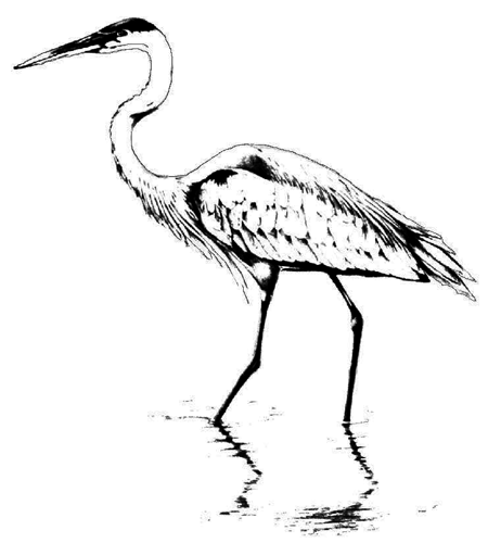
The term habitat refers to the kind of place where an organism normally lives. It includes the arrangement of food, water, shelter and space that is suitable to meet an organism's needs. You can think of this as the "address" where an organism lives. In contrast, a niche is the "occupation" of an organism. It defines the role of an organism in an ecosystem, such as a "fish-eating wader" for a heron, or a "plant-juice-sipping summer buzzer" for a cicada. An organism's niche may change during different life stages. For example, a tadpole typically lives in the water and eats plant material, while the adult frog may catch insects from the shore.
The source of energy for all life on Earth is the sun. Green plants (and some bacteria) are the only organisms that can directly capture the sun's energy and change it into a form that other organisms can use. Through the process of photosynthesis, plants use sunlight to change carbon dioxide and water into sugar and oxygen. The oxygen is given off into the air, where it is available to other organisms including humans. Simple sugar molecules make energy available to plants and, by forming the basic units of complex carbohydrates, contribute to plant structure. Other organisms then eat the plants, or eat organisms that eat plants, and in doing so indirectly gain the benefit of the sun's energy to run their bodies. The flow of sunlight energy is therefore passed from producers (green plants) to primary consumers (animals that eat plants, such as leafhoppers) to secondary consumers (animals that eat other animals, such as birds); this sequence is known as a food chain. As energy is passed along the food chain, much is used up at each level as it works to run each organism. This energy is given off as heat and results in less energy being available at each stage along the food chain. It takes a lot of grass to support one rabbit, and many rabbits to support one hawk. As a consequence, there are many, many green plants on the Earth, fewer animals that eat plants, and even fewer animals that eat animals; this is known as the energy pyramid. In the bosque, the cottonwoods and other plants trap the sunlight energy and provide it in a form usable by the entire collection of other organisms found there. They provide the foundation for life along the river.
Although sunlight energy is used up as it is passed along the food chain, fortunately there is an abundant supply of this energy. In contrast, the materials from which all living things are made are limited in supply and must be used over and over. The primary building blocks of all living things include only six materials: carbon, hydrogen, oxygen, nitrogen, phosphorus and sulfur. When an organism dies and decomposes, these materials are returned to the system and are used again. The carbon that was once part of a dinosaur's tail may now be in the tomato that you eat for dinner! If these compounds are removed from the cycle in some way, they may become limited in supply. For example, if a tree dies but the wood does not readily decompose, carbon and other nutrients are trapped in the wood and are not available to other organisms. This appears to be happening in the bosque. Without the annual flooding that once inundated the forest, wetting the fallen wood and increasing the rate of decomposition, undecomposed wood is now building up and trapping nutrients. This affects the health of the entire ecosystem.
One very important cycle is the water cycle. Rain that falls on a hillside percolates down into the ground water, or may flow aboveground into a lake or the ocean. Water in the lake or ocean then evaporates, and drops join together into clouds, to eventually fall again as rain. Our use of water greatly affects the water cycle. In New Mexico we remove water from the underground aquifer (water present in the bedrock below ground) much faster than it is replenished. Much of this water evaporates directly into the atmosphere while we use it, and may then fall again somewhere else on the planet, thus reducing the amount of water available locally.
We also impact the cycling of materials by introducing poisons. As materials are cycled over and over, toxins build up. Concentrations of toxins increase along food chains, since a predator eats many prey with the toxin, a process known as biomagnification. These increasing concentrations of toxins often have devastating effects. Some well-known examples include top-predator species such as bald eagles and peregrine falcons that nearly became extinct due to the effects of DDT or other chemicals. Awareness of these problems may go a long way towards helping to keep our cycles clean.
Through the flow of energy and the cycling of materials, all living things are interrelated. A mouse not only gets energy from the seeds that it eats, but also gets materials that will help to build more mouse tissue. The mouse breathes out carbon dioxide which is taken in by plants, which in turn give off oxygen used by the mouse. The mouse also depends on plants for finding shelter, and it provides food for a snake or owl. The components of the bosque are interrelated with connections extending to the surrounding uplands as well. Some connections are obvious, such as birds that fly between the bosque and uplands at different times of day or during different seasons, moving materials from one place to another. Others are more subtle, such as water flowing underground. But these connections make our actions even more important. Pesticides applied to our fields may add toxic materials to the river, affecting not only the water itself but also all the organisms that depend on that water.
Change is an integral part of the natural world. Changes may occur over geologic time, such as the transition of the Rio Grande from a series of lakes to the river that we know today, or they may occur over much shorter time periods, such as the transition of a seed to a tree and finally to a fallen log. Change was once an integral part of the natural Rio Grande riparian ecosystem, as the river wandered across the floodplain leaving behind its ever-changing mosaic of vegetation. However, human-induced changes have much different effects on the ecosystem. The rate at which we are causing changes on Earth is much greater than has been known previously, and we do not yet know the ecological consequences of most of our actions. By understanding the ecological systems in which we live, and how we interact with them, we can begin to lessen our impact on Earth.
Biodiversity and Conservation
Two phrases that have become commonly used by biologists and natural resource managers, and now also by policy makers, the media and the general public, are biological diversity (typically shortened to biodiversity) and biological integrity. These phrases represent concepts that are critical to developing strategies for the preservation of biotic systems, yet they are often used imprecisely, without a true understanding of the underlying concepts. The Office of Technology Assessment, in a report titled "Technologies to Maintain Biological Diversity," defines biological diversity as "the variety and variability among living organisms and the ecological complexes in which they occur." Thus biological diversity, or biodiversity, is really much more than just the species richness (the number of species) or species diversity (a measure of both the number of species and their relative abundances) at a given site. Biological diversity is a more comprehensive concept that considers several types of classification. For example, we can consider not only the number of species at a site, but also the representation of different higher levels of taxonomic classification such as the number of families or orders present. Likewise, we can consider genetic variability within a population or among different populations. Genetic variation among populations is reflected in "subspecies" designations, and these local populations or subspecies are often threatened or endangered. Finally, we can consider ecological diversity at a number of different levels. One example of this is the number of ecosystems represented within a landscape, such as the presence of the habitat mosaic within the Middle Rio Grande Valley. All of these concepts are important when considering biodiversity.
Biological integrity refers to the wholeness of a system, which includes the presence of all of the appropriate components and of all appropriate processes. Thus not only must the correct native species of plants, animals and microorganisms be present, but also the numerous processes, such as nutrient cycling or energy flow, should be occurring at their correct rates. This reflects the capacity of the system to recover after disturbances. The biological integrity of the Rio Grande riparian forest has been greatly compromised since the water in the river has been regulated. Natural processes such as flooding, which affects, for example, rates of decomposition of dead plant material and recruitment of young woody plants, have been altered. Thus the riparian forest now is not self-sustaining. Conservation and restoration efforts focused on promoting the biological integrity of a system are much more effective than those designed simply to save individual species. This is an important concept along the Rio Grande.
Keystone species are important to the maintenance of local biodiversity. A keystone species is a species that has strong regulatory effects on the composition of the community, even though it may be in relatively low abundance compared to other members of the community. The presence of the keystone species in some way determines which other species of organisms can be present. For example, in montane river systems beavers act as keystone species through their engineering feats: the construction of beaver dams and ponds creates habitat for many other aquatic plants and animals. When beavers are removed, the ponds are not maintained and many other species are eventually lost. Other examples are large herbivores such as elephants and rhinos in the African savannas, sea otters in the great kelp forests off the western coast of North America, and starfish in the intertidal zone. In the local bosque, the Rio Grande cottonwood is considered a keystone species because it provides the physical structure for the forest itself. Without cottonwoods, certain species of animals, such as cavity-nesting birds or insects that feed on cottonwoods, will not be supported. The presence of the cottonwoods creates the physical conditions that allow other bosque plants to grow. A complete loss of cottonwoods will certainly change the structure and composition of the local riparian forest.
Activities and Resources
Chapter 3: Going Out - Field Activities
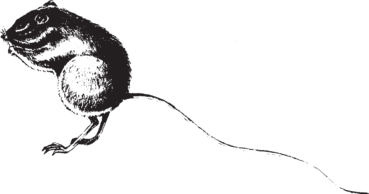
This chapter compiles an assortment of field activities to support multiple visits to the bosque. These include activities that support observation skills for a class's first introductory field trip, as well as activities to develop students' critical-thinking skills in follow-up field trips.
Planning a Bosque Field Trip
Riparian forests are magical places. This rare and endangered ecosystem is unlike most of our arid state, so just entering the forest can be unlike anything students have previously experienced. In order to understand the complexity of the bosque ecosystem, students must first gain an appreciation for its diversity and for the uniqueness of this valuable habitat. The Going Out activities in this section encourage students to explore and discover the hidden, and not-so-hidden, secrets of the bosque and adjacent wetlands. In doing so, particularly with repeated exposure, students develop a sense of belonging to the bosque that will encourage them to want to learn more about its science and to support its protection. They develop a sense of place.
We encourage you, if at all possible, to take regular trips to the bosque or other natural area. This might be monthly, or once per semester, but the more frequent the better. These activities are designed to promote observation skills. They focus on discovery and exploration, and some include more advanced skills of data collection and analysis, and plant and animal identification.
Many of the Going Out activities can be used as springboards to Common Core/ELA and Math standards. You can write poems and stories based on observations written in journals, read field guides about bosque-related organisms during sustained silent reading, use Bosque Search cards to help build vocabulary, or conduct independent research based on questions that arise while in the bosque. Or, estimate the percentage of cottonwood leaves that have turned yellow or brown, convert temperatures between Fahrenheit and Celsius, or graph data collected in the field. Be creative, and try using these Going Out experiences for many of your required standards. The possibilities are endless!
If you can only do one activity in this section, we encourage you to try Bosque Field Journals. As you will see in the background to that activity, there are numerous benefits to using field journals on a regular basis, and they can be used to address Common Core/ELA standards as well as science standards. They can be combined with science journals and/or writing journals, and can become part of your daily schedule. Field journals can be used in the bosque, in other natural areas, or on your school campus. We urge you to make them a regular part of your syllabus!
Practical Field Trip Tips for Educators
- It helps to have a colleague join you for your first trip out, or plan to take combined groups with older and younger students working together.
- Ideally, plan on one adult (teachers, aides, parents) per 4-5 students. Extra adults help with safety, can be assigned small tasks and can help students with prompts. Provide specific guidelines for how chaperones can help students. Parents always enjoy their time outside!
- Make reservations with the agency to be visited for the field trip. Discuss with agency contact the purpose of field trip, and clear lunch or snack plans.
- Complete individual school or district permission forms for field trip.
- Arrange transportation.
- Give informational letters to parents—include list of items for students to bring and an overview of the trip.
- Make a pre-trip visit to the site of field trip to be familiar with the area and to prepare student activities. Scout out places to go that will allow your class to break into smaller groups of 4-5 students while still staying on the trails. For example, intersections of trails allow groups to go in several directions while remaining close by. Utilize picnic areas, outdoor classrooms, or other space designed for group use.
- Prepare Bosque Education Guide activities.
Things to Bring on a Field Trip
- As appropriate, younger children should be clearly labeled with first name, school name and telephone number.
- Dress for the weather. Winter weather requires a water bottle and, as a minimum, a jacket; hat and gloves are recommended. Summer weather requires sunscreen, hat, water bottle and insect repellant. Long pants and sleeves protect against insects and bosque shrubs; however, students should remain on trails away from most hazards. Shoes during any season should be sneakers or boots. Sandals are not appropriate for trail walking.
- Water should be available in any season.
- Educators should have the paperwork required by their school for field trips, including emergency contact numbers, in their possession.
- Each student should wear a backpack to carry journals, pencils and other journaling supplies, water bottles, lunch, extra clothing, etc. This allows hands to be free for exploring and also prevents items from being dropped and lost somewhere along the trail.
- Bring (and use) a litter bag.
- Bring cameras, binoculars, field guides.
- Bring a first-aid kit, but know your school's rules on liability.
- A small dry-erase board, marker and tissues are helpful to use in the field to write journal information, show how to set up columns or horizontal rows, show spelling, etc.
- Use established picnic areas where available for lunches, but it is ok to sit on the ground to eat lunch as well! It is good for students to become comfortable eating outside. Always be sure to leave nothing behind when you leave; even small pieces of food should be picked up. Remind students that human food is not always good for animals to eat.
Review Rules and Expectations
Students need to understand that they are visiting another creature's home and should treat it with respect. In addition to your personal class rules for discipline, you should encourage the following:
- Use walking feet and quiet voices so as not to disturb animals.
- When students find something that they want to share, let them do so but please return everything (except trash!) to the place where they find it. A good rule is to allow students to pick up insects (within reason) and things that are "dead, down and on the ground." Point out that many organisms (including animals, plants, fungi) live in the bosque and that you are visitors in their home. Everything belongs there and should be left, whether it is a rock, a feather or a piece of bark. An exception is with the "Find a Friend" prompt; students may carry their friends around while in the area, but be sure to return friends before leaving.
- Be gentle with any creatures you might pick up. Please discourage squashing spiders or stepping on ants; remind students that these creatures are living beings just as we are, and are part of the ecosystem. Note that handwashing is important before touching living creatures, particularly amphibians as they are especially sensitive to chemicals found in mosquito repellent, sunscreens, etc.
- Please do not pick living plants, and take care not to trample plants when walking (stay on trails as much as possible).
- These activities encourage exploration, but safety should also be a concern. There are areas of the bosque where students can get disoriented and lost. Set boundaries for exploration, such as "You must stay between this road, the jetty jacks and the river" or "within sight of the teachers" or "behind one teacher and in front of another."
- Practice "Leave No Trace" principles.
Destination Options
There are many places to get to the bosque and take a walk. Maybe there is great access just down the road from your school!
But, if you are looking for some additional resources such as rest rooms or facilitators with field equipment to use, here are some examples:
- Bachechi Open Space, Bernalillo County
- Bosque del Apache National Wildlife Refuge, Socorro County
- Rio Grande Nature Center State Park, Albuquerque
- Valle de Oro National Wildlife Refuge, Bernalillo County
- Whitfield Wildlife Conservation Area, Valencia Soil and Water Conservation District, Belen
Going Out – Fun Facts
There are many interesting things to discover in the bosque. Here are some fun facts to share with students about things they may find:
Chewed leaves are mostly chewed by arthropods, including insects and isopods (pillbugs and woodlice). Isopods, now the primary detritivore (dee-TRY-ti-vore; eater of dead plant or animal material) in the bosque, were introduced into this ecosystem from Europe!
Cottonwood cotton is the seed of the cottonwood tree. The fine cotton-like fibers surrounding the tiny seed allow the wind and water to transport the seed. Cottonwood trees are either male or female. "Cottonless" cottonwood trees are male trees. They produce pollen from long, red clusters of flowers (called catkins). Only female trees produce seeds; the developing female catkins are locally known as tetones and resemble peas until they open. Cottonwood seeds or cotton "fly" in late May or June, but old cotton can be found year-round under logs or in crevices.
Rolled leaves are created by a caterpillar for its home. The caterpillar eventually becomes a small moth. They can be hard to find!
Star twigs: Have students pick up a cottonwood twig from the ground. Find a terminal bud scale scar (See "Winter Bud Activity" for an illustration). It looks like a ring or collar that circles the twig. Snap the twig in two at this point. Look at the star shape formed by the pith of the twig, the cells in the center of the stem.
Chapter Activities
- Bosque Field Journals (PDF)
- Signs of Humans (PDF)
- Naturalist Notebooks (PDF)
- Wildlife Detectives (PDF)
- Crawly Creatures (PDF)
- Dip-Net Critters (PDF)
- A Rose by Any Other Name (PDF)
- Reading the Bosque (PDF)
- Winter Buds (PDF)
Spanish Activities
- Spanish My Bosque Discovery Booklet (PDF, 72 KB)
- Spanish Field Booklet (PDF, 68 KB)
- Spanish Bosque Search Bingo (PDF, 208 KB)
- Spanish Notebooks (PDF, 88 KB)
Acknowledgements for Revisions, January 2023
Funding from: New Mexico Department of Game and Fish, Share with Wildlife Program
Writing Group: Letitia Morris, Lisa Ellis, Karen Herzenberg, Molly Madden
Layout: Laurel Ladwig
Advisory Group: Selena Connealy, Heather MacCurdy, Deb Novak, Jennifer Owen-White, Kelly White
Teacher Fellows: Helen Haskell, Stephanie Kichler, Shirley L. Pareo Srouji, Laura White
Contributors: Darlene Fraher, illustrations
Additional Reviewers: Nell Burrus, Karen Gaines, Amy Grochowski, Allison Martin, Fiana Shapiro, Storm Ussery
Thanks to the Friends of the Rio Grande Nature Center.
Chapter 4: River of Change
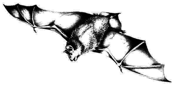
This chapter is devoted to creating a cloth and paper model of the river valley that provides a hands-on approach to understanding river and floodplain ecology in the Southwest. The basic activity, "Changing River," provides a setting for the subsequent activities that explore the roles of animals, plants, cottonwood trees, agriculture, and change in the river of the past (Rio Bravo), the present (Rio Manso), and the future (Rio Nuevo). By creating models of these three stages of the Rio Grande, the powerful teaching technique of contrast is used to clarify the role humans have played and can play in this river ecosystem.
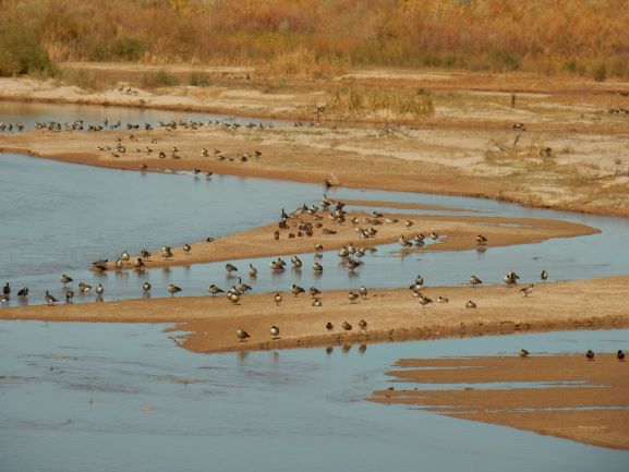
Chapter 4 Activities
Changing River: In a directed class activity, students construct a paper and cloth model of a section of the Rio Grande Valley as it was before major human intervention, and then manipulate it to demonstrate the human-caused changes over the last century. In the context of today's river, the students contrast the differences between managing the river for only human benefits and managing the river with broader objectives of both ecosystem health and human needs. They then construct a model of the river of the future using those broader objectives.
The rest of the activities in Chapter 4 are based on the Changing River activity above. In practice, we have found that these remaining activities work well alone, in separate sessions, or combined.
Cottonwood Creation: Students learn about cottonwood seedling survival. In Part One, students identify the conditions a cottonwood seed needs to germinate (start growing) by tossing cotton balls on the river model. In Part Two, students use coins or dice as they try to grow seedling roots fast enough to keep up with a lowering water table. Students realize that very few cottonwood seeds actually become trees and that altered river conditions are very limiting for cottonwood establishment. This activity delves into a specific example of a species and its survival—what allows a species to continue to exist in its location.
Who Lives Where?: Students explore animals' niches in bosque habitats using the Changing River model and see how human-caused changes to the bosque impact the ability of animals to survive and thrive over time. A section discussing threatened and endangered animals and introduced and non-native species is included. There are 48 native and 10 introduced bosque animal species illustrated with detailed natural history information.
Who Grows Where?: Students explore plants and the role plants play in the bosque ecosystem using the Changing River model and see how human-caused changes to the bosque impact the ability of plants to survive and thrive over time. There are 25 native and non-native bosque plant species illustrated with detailed natural history information.
Working Water: Concentrating on the agricultural aspect of the Middle Rio Grande Valley, students create an irrigation system on the Changing River model, expanding on and exploring human influence on the Rio Grande created in the Rio Manso river model.
Bosque Chaos: By the roll of the dice, students use the Changing River model to see how chance influences natural and human-caused changes in the bosque.
Download all of Chapter 4 (PDF, 1.99 MB)
Activities
Next Generation Science Standards – NM STEM Ready! Science Standards Aligned
- Changing River (PDF)
- Cottonwood Creation (PDF)
- Who Lives Where? (PDF)
- Who Grows Where? (PDF)
- Working Water (PDF)
- Bosque Chaos (PDF)
A Note about Science Standards
The Chapter 4 River of Change activities are correlated with New Mexico STEM Ready! Science Standards; these include both the national Next Generation Science Standards (NGSS) and New Mexico-specific performance expectations. These are highlighted in three places:
- Standards are listed at the beginning of each activity in a call-out "Standards Box."
- Specific questions and prompts help students critically think about the concept to be addressed. The appropriate Disciplinary Core Idea (DCI) code, Crosscutting Concept (CCC), and/or Science and Engineering Process (SEP) that relate to each concept are highlighted directly in the text.
- At the end of each activity, there are more detailed entries addressing how the activity particularly helps students with that specific DCI.
New Mexico STEM Ready! Performance Expectations for 5th grade and middle school fit into our scope, and new connections specifically addressing these standards are included.
Appendix K (PDF) shows which activities address which standards.
Chapter 4 includes detailed information cards and illustrations for the following animals and plants that live in the Middle Rio Grande Valley.
Animals
Animals are found in the Who Lives Where? activity PDFs, pages 202–233.
Who Lives Where? Rio Bravo: Native Animals
Arthropods
| Common Name | Scientific Name |
|---|---|
| Mayfly | Baetis sp. |
| Field Cricket | Gryllus sp. |
| Plains Cicada | Megatibicen dealbatus |
| Caddisfly | Hydropsyche sp. |
| Harvester Ant | Pogonomyrmex sp. |
| Leaf-roller | Anacampsis innocuella |
| Mosquito | many spp. |
Fish
| Common Name | Scientific Name |
|---|---|
| Shovelnose Sturgeon | Scaphirhynchus platorynchus |
| Rio Grande Bluntnose Shiner | Notropis simus simus |
| Red Shiner | Cyprinella lutrensis |
| Rio Grande Silvery Minnow | Hybognathus amarus |
Amphibians
| Common Name | Scientific Name |
|---|---|
| Western Chorus Frog | Pseudacris triseriata |
| Northern Leopard Frog | Lithobates pipiens |
Reptiles
| Common Name | Scientific Name |
|---|---|
| Western Painted Turtle | Chrysemys picta |
| Spiny Softshell Turtle | Apalone spinifera |
| New Mexico Whiptail | Aspidoscelis neomexicanus |
| Bullsnake | Pituophis catenifer |
| Gartersnake | Thamnophis sp. |
Birds
| Common Name | Scientific Name |
|---|---|
| Canada Goose | Branta canadensis |
| Mallard | Anas platyrhynchos |
| Greater Roadrunner | Geococcyx californianus |
| Yellow-billed Cuckoo | Coccyzus americanus |
| Sandhill Crane | Antigone canadensis |
| Killdeer | Charadrius vociferus |
| Great Blue Heron | Ardea herodias |
| Cooper's Hawk | Accipiter cooperii |
| Bald Eagle | Haliaeetus leucocephalus |
| Great Horned Owl | Bubo virginianus |
| Belted Kingfisher | Ceryle alcyon |
| Southwestern Willow Flycatcher | Empidonax traillii extimus |
| American Crow | Corvus brachyrhynchos |
| Summer Tanager | Piranga rubra |
| Red-winged Blackbird | Agelaius phoeniceus |
Mammals
| Common Name | Scientific Name |
|---|---|
| Desert Cottontail | Sylvilagus audubonii |
| Little Brown Bat | Myotis lucifugus |
| Beaver | Castor canadensis |
| Botta's Pocket Gopher | Thomomys bottae |
| New Mexico Meadow Jumping Mouse | Zapus luteus luteus |
| Muskrat | Ondatra zibethicus |
| White-footed Mouse | Peromyscus leucopus |
| North American Porcupine | Erethizon dorsatum |
| Coyote | Canis latrans |
| Mule Deer | Odocoileus hemionus |
Who Lives Where? Rio Bravo: Upper Watershed, Native Animals
| Common Name | Scientific Name |
|---|---|
| Rio Grande Cutthroat Trout | Oncorhynchus clarkii virginalis |
| Osprey | Pandion haliaetus |
| American Dipper | Cinclus mexicanus |
| Black Bear | Ursus americanus |
| Elk | Cervus elaphus |
Who Lives Where? Rio Manso: Animals Introduced to the Middle Rio Grande
| Common Name | Scientific Name |
|---|---|
| Isopods: Pillbug and Sowbug | Armadillidium vulgare and Porcellio laevis |
| Carp | Cyprinus carpio |
| Mosquitofish | Gambusia affinis |
| Bullfrog | Lithobates catesbeianus |
| European Starling | Sturnus vulgaris |
| House Sparrow | Passer domesticus |
| House Mouse | Mus musculus |
| Feral Dogs and Cats | Canis lupus familiaris and Felis catus |
Who Lives Where? Rio Manso: Upper Watershed, Introduced Animals
| Common Name | Scientific Name |
|---|---|
| Rainbow Trout | Oncorhynchus mykiss |
| Brown Trout | Salmo trutta |
Plants
Plants are found in the Who Grows Where? activity PDFs, pages 249–261.
Who Grows Where? Rio Bravo: Native Plants
| Common Name | Scientific Name |
|---|---|
| Rio Grande cottonwood | Populus deltoides subsp. wislizeni |
| New Mexico olive | Forestiera pubescens |
| Coyote willow | Salix exigua |
| One-seeded juniper | Juniperus monosperma |
| False indigo | Amorpha fruticosa |
| Western white clematis | Clematis ligusticifolia |
| Screwbean mesquite | Prosopis pubescens |
| Wolfberry | Lycium pallidum |
| Prickly pear | Opuntia spp. |
| Giant sacaton | Sporobolus wrightii |
| Sedge | Carex spp. |
| Saltgrass | Distichlis spicata |
| Smooth scouring rush or horsetails | Equisetum laevigatum |
| Yerba mansa | Anemopsis californica |
| Hooker's evening primrose | Oenothera hookeri |
| Broad-leaved cattail | Typha latifolia |
| Sacred datura | Datura wrightii |
| Sunflower | Helianthus annuus |
| Spectacle pod | Dimorphocarpa wislizeni |
Who Grows Where? Rio Manso: Plants Introduced to the Middle Rio Grande
| Common Name | Scientific Name |
|---|---|
| Saltcedar | Tamarix chinensis |
| Tree of heaven | Ailanthus altissima |
| White sweet clover | Melilotus alba |
| Russian olive | Elaeagnus angustifolia |
| Cheatgrass | Bromus tectorum |
| Kochia | Kochia scoparia |
Spanish Activities
- Changing Rivers – Spanish (PDF)
- Model Pieces – Spanish (PDF)
- Cottonwood Creations – Spanish (PDF)
- Who Lives Where? – ¿Quién vive dónde? (PDF)
- Who Grows Where? – ¿En dónde crecen estas plantas? (PDF)
- Working Water – Spanish (PDF)
- Bosque Chaos – Spanish (PDF)
Revisions, Spring 2020/2022
Funding from: New Mexico Department of Game and Fish, Share With Wildlife Fund
Writing Group: Letitia Morris, Lisa Ellis, Karen Herzenberg, Stephanie Kircher, Molly Madden, Kelly White, Laurel Ladwig, Layout
Advisory Group: Selena Connealy, Aryn LaBrake, Heather MacCurdy, Deb Novak, Jennifer Owen-White
Contributors: Reese Bice, illustrations; Katie Elder; Matt Schmader
Reviewers: Delfine Baca, Eric Griffin, Amy Grochowski, Candy Hodoba, Ani Jamgyal, Joan Morrison, Virginia Seamster, Fiana Shapiro, Storm Usrey
Chapter 5: Meandering Channels
This chapter compiles classroom and schoolyard-based activities that do not utilize the river model. These activities are grouped under the following topical subheadings: natural history, geology, water, and human influence. Within these activities, several essays provide additional in-depth background information on specific topics.
Geologic History of the Rio Grande Rift
By Jayne Aubele
New Mexico Museum of Natural History & Science
New Mexico is unique in many ways. One of the little-known reasons that it is unique is that it is the site of the Rio Grande Rift, which extends from southern Colorado (the San Luis Valley) down the center of our state and into northern Mexico* (see map and diagram on following pages). Much of the landscape, geology, and vegetation of New Mexico is related to the development and location of the rift. The Rio Grande exists because of the rift. Without the rift, there would have been no Rio Grande and no Rio Grande bosque.
Imagine a New Mexico without the Rio Grande, without the central mountains that today border the Rio Grande on the east, and without the abundant young volcanoes that today parallel the river. This was New Mexico near the end of the Mesozoic Era (65 million years ago [mya]). Streams flowing from west to east carried sediment from western New Mexico onto a flat plain that existed where today Albuquerque and the Sandia Mountains are located. How did New Mexico get from there to here? How did the Rio Grande Rift and the Rio Grande form?
Pushing and Pulling
The Earth's crust is actually made up of many huge, separate pieces; geologists call these plates. Plates cover the Earth much like giant puzzle pieces, but they are not static. They move in relation to each other. Two plates can slide past each other, move toward each other, causing mountain building or volcanism, or move apart from each other. New Mexico lies within a single plate, the North American plate, but our state has been affected by the movement of plates far away, along the western edge of the continent.
At the end of the Mesozoic Era, many small plates apparently began to crash into the western margin of the North American plate. These plates caused the continent to ripple like a rug being pushed from the edge. Geologists call this type of movement compression. The "ripples" became the modern Rocky Mountains, extending from Canada into northern New Mexico. The Sangre de Cristo Mountains in New Mexico are the southernmost expression of the modern Rocky Mountains.
There are only five known young (active or recently active) continental rifts in the world, and the Rio Grande Rift is one of them. A continental rift is a linear area where the crust within a continent is thinning and pulling apart. It is not the boundary of two separate plates, but instead it forms within a plate. It can, with time, develop into a plate boundary. The other young active continental rifts in the world are: (1) the East African Rift; (2) the Rhine Valley in Germany; (3) the Baikal Rift in Russia; and (4) a recently identified rift beneath the ice in Antarctica.
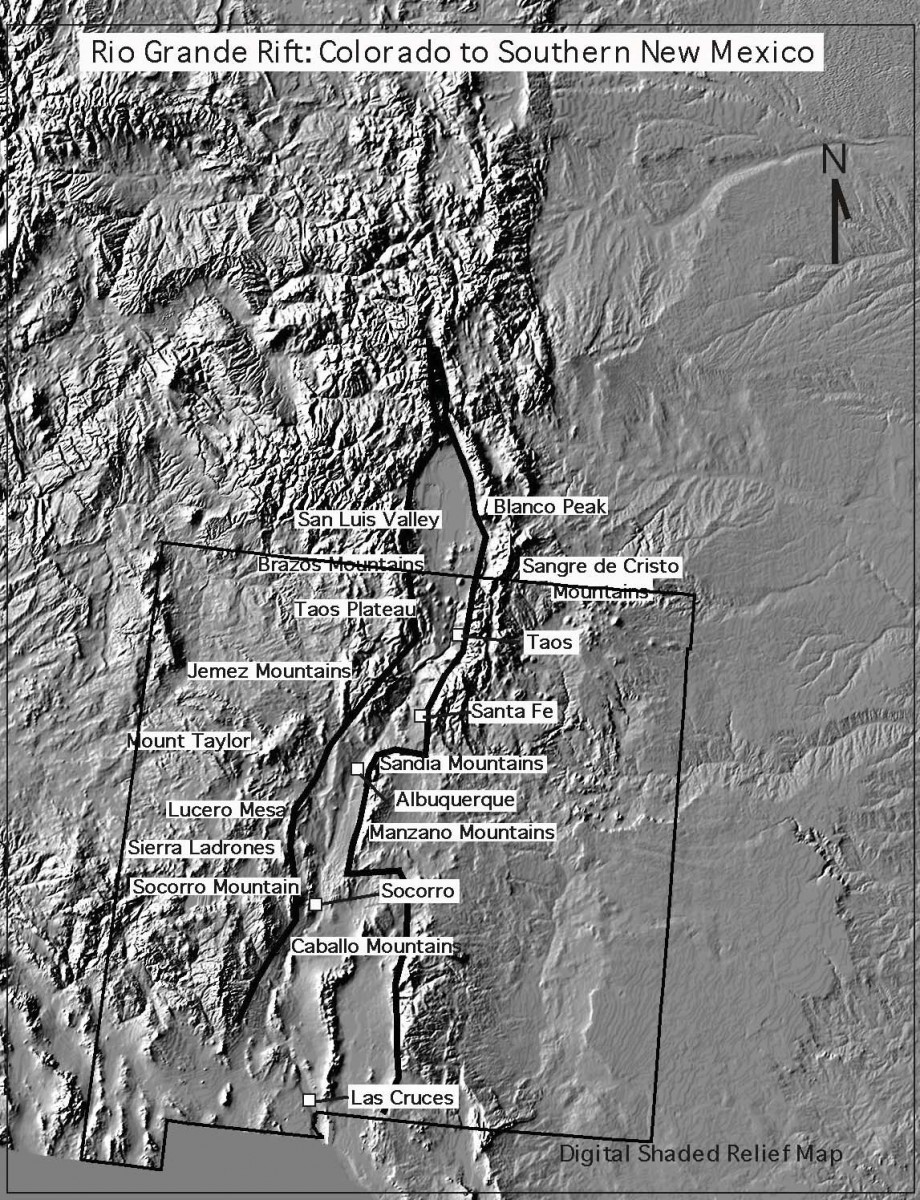
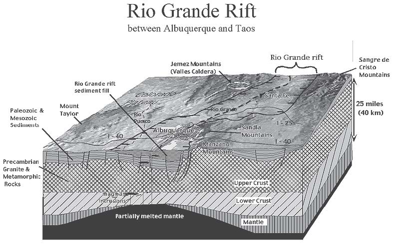
As plates continued to crash into the western edge of the continent, some pieces of the plates attached to the edge of the continent. What we now call California was added to this edge. Apparently, at least one plate actually began to move beneath the continent. As this plate traveled from west to east beneath the continent, a wave of volcanic eruptions occurred throughout what would become the western U.S. These volcanic eruptions occurred from 60 to 20 mya and formed the Superstition Mountains in Arizona, the San Juan Mountains in Colorado, and the Mogollon–Black Range–Magdalena–Socorro–Organ Mountain province in New Mexico. Sierra Blanca, the Cerrillos Hills, the Ortiz Mountains, and a volcano that was eventually eroded partially away to form Shiprock also erupted during this time. The "Age of Volcanoes" in New Mexico began during this period and has continued to today.
It's All California's Fault!
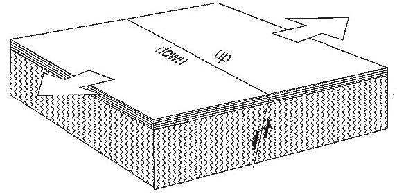
About 20 mya something happened to the movement of the North American and Pacific plates. There may have been a redistribution or reorientation of their movements, as occasionally happens, and the compression of the North American continent ended. Instead of pushing the continent into mountainous "ripples," the plate bounding the western edge of the continent began to slide northward along the edge of the continent. This movement continues today and is the cause of the San Andreas fault zone in California. This sliding motion began to tear or pull apart the southwestern region of North America. Geologists call this type of movement tension or shear. As this movement continued, it caused the pulling apart of what is now the southwestern U.S. A series of roughly parallel, north-trending, deep, elongated valleys with intervening mountain ranges was created by this pulling apart of the continent. If you drive through southern Arizona or Nevada today, you see these parallel valleys and mountains in what is called the Basin and Range Province.
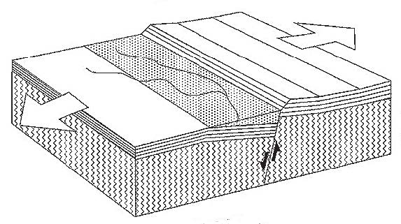
During this time, something strange happened in the Four Corners area of northwestern New Mexico, northeastern Arizona, southeastern Utah, and southwestern Colorado. This region, which geologists named the Colorado Plateau, was a shallow circular valley during the Mesozoic Era (Triassic, Jurassic, and Cretaceous Periods) and had layer upon layer of rock units deposited on it in a flat layer-cake sequence. At the end of the Mesozoic Era, when the Rocky Mountains were uplifted, and during the Tertiary Period (60–20 mya), when extensive volcanism was occurring in the western U.S., very little seemed to affect this region. When the continent began to pull apart 20 mya, the Colorado Plateau still was not affected. It stayed as a stable, layered piece of continental crust, while the rest of the continent broke apart into a series of valleys around it. If you pin a piece of paper to a bulletin board with a single pin and then pull on that piece of paper from one direction, the paper will begin to rotate and tear around the pin. That is what happened to the southwestern North American continent. As the continent began to pull apart and rotate around the Colorado Plateau, valleys were created to the south and west of the plateau, and a large valley began to form east of it. This "valley" is the Rio Grande Rift.
Like Pizza Dough . . .
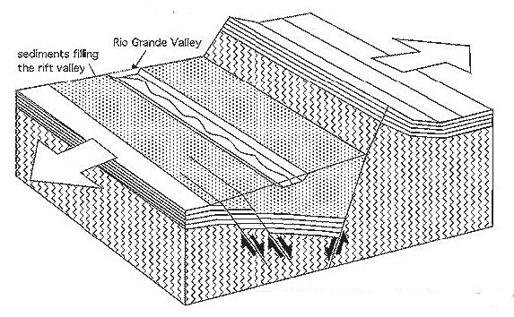
A geological rift forms by the pulling apart and thinning of the Earth's crust. You can think about it as though it were pie crust or pizza dough rolled out with a rolling pin and then pulling apart from both sides. If you have ever done this with dough, you know that it does not break in a straight line down the center. Instead, it breaks apart in a series of oval openings that occur as you continue to pull, and the dough thins and breaks. This is exactly the way the Earth's crust responds to tension. In fact, the Rio Grande Rift has formed as a series of oval basins or depressions, outlined by faults, that extend in a slightly offset line from southern Colorado to northern Mexico. The escarpment known as La Bajada, between Santa Fe and Albuquerque, forms a margin between two of these basins. The city of Albuquerque was built on top of the eroded debris filling one rift basin to the south of La Bajada, and the city of Santa Fe was built in the basin to the north of La Bajada. A similar situation has occurred just south of Socorro.
As the basins began to form, the continental crust thinned and dropped down to form low areas. Thinner crust meant that it was easier for magma to reach the surface, so volcanoes began to erupt in the center of the rift. Volcanoes from Taos to Carrizozo erupted. In many places, such as west of Albuquerque or Los Lunas, these volcanoes form alignments that are called "fissure vents," where many small volcanoes erupt in a line. In the Albuquerque area, the width of the rift extends from the Sandia Mountains to the Rio Puerco, with the Albuquerque volcanoes right in the center of the rift.
The series of cracks in the crust at the edges of the rift, called boundary faults, became very complex. Some of the margins of the rift began to be uplifted into the modern central mountains of New Mexico, including the Sandia, Manzano, Manzanita, and Sierras de los Pinos Mountains. The Sandia Mountains near Albuquerque probably began to rise only 5–10 mya, making them geologically young and NOT part of the Rocky Mountains. The Rio Grande Rift and the mountains that form the rift's margins continue to be geologically active today.
The series of rift basins, with uplifted margins, formed a perfect low area for water to flow. As water runoff began to form in northern mountains, such as the San Juans, the water began to integrate into a permanent through-going river that took advantage of the low area. Most geologists believe that the Rio Grande formed as a major river 1–2 mya.
Most river valleys are eroded or cut by the rivers that flow within them. Unlike most rivers, the ancestral Rio Grande did not erode the broad, flat valley through which it now flows; it simply took advantage of this linked series of basins or low areas.
Activities
- Mapping Species Richness (PDF)
- Time Line Activity (PDF)
- What is the Rio Grande Rift? (PDF)
- WebQuest: Geologic History (PDF)
- Porosity and Permeability (PDF)
- Rio Grande Water Cycle (PDF)
- Surface Water Demo (PDF)
- Watersheds in New Mexico (PDF)
- Rio Grande Stream Table (PDF)
- How Deep is the Water Table? (PDF)
- Water Budget Activity (PDF)
- Interpreting a Hydrograph (PDF)
- Change is All Around Us (PDF)
- The Web (PDF)*
- Bosque Bugs Boogie (PDF)*
- Bosque Survey (PDF)*
- Mapping Species Richness (PDF)*
- Crane Migration (PDF)*
- Invasive Species (PDF)*
Download all of Chapter 5 (PDF)
*Next Generation Science Standards – NM STEM Ready! Science Standards Aligned
Chapter 6: Fire in the Rio Grande Bosque
Fire in the Bosque
By Lisa Ellis, Ph.D.
University of New Mexico Department of Biology
Fire in the bosque! Dry weather and a changed bosque ecosystem have made this a common cry in recent years. Large bosque fires have increased public awareness of this fragile ecosystem, but there is still much to learn about riparian fires. Even land managers are still trying to understand the role that fire plays here and the best ways to protect bosque plants and animals. Just what do we know?
Fire in the Southwest
Fires are quite common in the southwestern U.S., particularly during the normally dry late-spring-to-early-summer season. In addition, regional fire patterns are tied to the El Niño–Southern Oscillation (ENSO) cycles: many large fires typically occur throughout the region during years influenced by the dry La Niña phase, when precipitation is well below average. Since the early to mid-1900s, the frequency of dry summers has increased, there have been more human-caused fire ignitions and fuels have accumulated due to fire suppression. Consequently, frequency, size and severity of fires in the region also appear to be on the increase.
Until recently, fire suppression was the goal of wildland resource management. Land managers now recognize the important role of fire in many of our natural ecosystems. In grasslands and ponderosa pine forests, for example, periodic disturbance from fire is important. Plants in these ecosystems have adaptations to survive fires, and they respond quickly after these events, by re-sprouting or releasing seeds. Many species fully depend on fire for regeneration. Fire also helps to break down nutrients from standing plant material and returns them to soil, making them more available for future plant uptake.
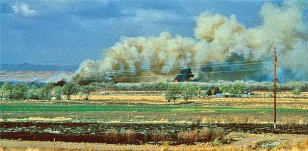
This fire burned rapidly in the bosque south of the Interstate 25 bridge near Isleta on March 23, 1996, a very windy day. Photo by Tish Morris.
The role of fire in lowland riparian forests of the arid Southwest, however, is not well known. Although the Rio Grande bosque must have experienced fires, it seems likely that fire was not an important part of this system prehistorically. Native Americans may have burned the bosque occasionally to clear for agriculture, and grassland fires may have burned into the riparian zone from surrounding uplands, but fires would have been less severe than they are today due to lower fuel supplies. Before people altered the river and decreased the frequency and extent of flooding, flooding promoted decomposition of leaves and wood, and thus decreased accumulations of fuels available for fires. In addition, flooding dampened the forest floor and thus directly inhibited fires. Since humans have altered the natural flow regime along the Rio Grande, the decrease in flooding has resulted in an increase in fuel loads, and subsequently fires, in the bosque.
These lowland riparian bosques are adapted to disturbance, particularly to flooding and herbivory by animals such as beavers, but it is unlikely that fire was among the important forces shaping the evolution of Rio Grande cottonwoods. Re-sprouting is a common adaptation among some cottonwood species to disturbance by flooding and by other forms of severe defoliation (loss of leaves). Cottonwoods can re-sprout from their roots and from the base of the trunk after light fires, but in severe fires, mature tree mortality is very high. Typically, all above-ground tissues are killed in severe fires. Other plants native to Rio Grande riparian bosques also can re-sprout after less severe fires, including species such as seepwillow, New Mexico olive and Goodding's willow. However, long-term data on post-fire survival for these species are unavailable, so our understanding of fire in this ecosystem remains limited.
Over the last century, non-native plants have flourished in the bosque, bringing different dimension to fires that occur there. Some non-native plants, particularly saltcedar, also sprout well after lighter fires. Further, the accumulation of the very flammable leaf litter from saltcedar is thought by some researchers to promote fires. Although the leaves contain volatile oils, they also tend to have a high moisture content, so it is the accumulation of leaf litter and dead woody material within the plants that increases flammability. One consequence of severe fires that kill the large cottonwoods is that after the mature trees fall, clearings are created that provide habitat for the establishment of new trees. Prior to the invasion by saltcedar and alteration of the river's flow, these clearings would have been flooded and colonized by young cottonwoods and other native plants. Today, however, they are more often colonized by saltcedar, which releases seeds over a longer period of time and can take advantage of late-summer rains for establishment. Further, saltcedar has been observed to flower more heavily after a fire (stress-induced flowering), which increases the production of seeds available to colonize these clearings. Thus saltcedar may both promote and benefit from large fires in the bosque.
What Makes a Fire?
Fire needs three elements to burn: heat, fuel and oxygen. These three elements make up the fire triangle, and all three must be present for fire to ignite and spread. The initial heat is provided by an ignition source, for example a lightning strike, a lighted cigarette or a stray firework. This source of ignition must find sufficient fuel to burn, such as dry leaves and grasses, dead trees or fallen branches; there must be both something that lights easily to start the fire and a sufficient quantity of fuel to maintain it. Oxygen is readily available in the air. Weather conditions can affect the likelihood of a fire occurring. Hot temperatures and dry winds—conditions typical of late spring and early summer in New Mexico—promote the spread of fire, while fires are less likely to occur in cold and wet conditions.
How Do We Fight Bosque Fires?
The Rio Grande bosque is part of both urban and agricultural communities and is a wildland–urban interface where fire in one threatens the other. A house fire can start a bosque fire, and a bosque fire can start a house fire. Reducing fire risk in the bosque is an important part of protecting adjacent communities. The Wildland Fire Task Force of the City of Albuquerque is charged with suppressing any wildland fires that occur within the Albuquerque city limits and surrounding areas. The task force includes personnel and equipment from six fire stations that are located either by the Rio Grande bosque or on the east or west mesas. These personnel are specifically trained to fight wildland fires. Fire-fighting equipment used by this crew includes front-line emergency response equipment as well as two brush trucks (one capable of foam production) and two four-wheel-drive all-terrain vehicles (with a towing trailer). These crews are also equipped with personal protective equipment, portable drafting pumps and hand tools designed for wildland or brush fire fighting. Similar equipment is used by crews along other reaches of the Middle Rio Grande Valley.
Fires in the bosque provide some unique obstacles in suppression. The primary constraint is due to restricted access within the levees. Jetty jacks represent very real obstacles to fire fighting access—trucks cannot get into much of the bosque area due to jack lines. Only smaller trucks are able to follow levee roads. Hand crews face problems, too—Russian olive and black locust have very painful thorns!
Fire suppression techniques depend in part on the size of the fire. With flames up to three feet (1 m) high, firefighters can fight the fire directly with hand equipment. Bulldozers are used to fight flames that exceed three feet, up to 12 feet (1–4 m). Water drops from helicopters and cargo planes are used when flames exceed 12 feet (4 m).
Recent Fires in the Bosque
Today, fires in the bosque tend to be caused by humans, with lightning-caused fires being relatively rare. During a 10-year study period (1986–1995), UNM graduate student Mary Stuever found that most fires in the Middle Rio Grande bosque occurred between February and April, though in some years there was an increase in mid-summer and/or fall fires. One of the main causes of bosque fires—debris burning—typically occurs during the late-winter to early-spring period when farmers are preparing fields and acequias for the growing season. Other common causes of bosque fires include arson, illegal campfires, children and careless disposal of smoking materials.
New Mexico State Forestry Division data show that 534 fires occurred on Middle Rio Grande Conservancy District lands in the Middle Rio Grande Valley during 1993–2003, with fires burning in all months of the year. By far most fires occurred during February through July. Very large fires were not common; only 4 percent of all fires burned over 100 acres (40 hectares), with most fires (82 percent) less than 10 acres (4 ha) in size, and 14 percent of all fires burning between 10 and 99 acres (4 and 39.6 ha). All fires that burned over 100 acres (40 ha) occurred during March through June, with 13 of these 23 fires occurring in April. Most of these large fires burned in Socorro County.
Post-fire recovery work in the Valley has changed over the years as our understanding of the system and management options has grown. Initially, burned sites were simply left alone, with no post-fire restoration attempted. Later, restoration work focused on replanting native trees into large monocultures, with no effort to plant understory shrubs or grasses. Burned stumps were ground out and removed. Now there is more of an attempt to restore the mosaic of habitats once present in the valley. In addition to pole-planting cottonwoods and willows, workers plant understory shrubs and spread seeds for native grasses. Stumps of native species are left to re-sprout and constructed wetlands may be added. Heavy machinery is often used to remove burned wood from sites or to chip remaining wood. Herbicides are sometimes used to kill stump-sprouts of exotic species such as saltcedar, with follow-up treatments in subsequent years. Remaining live native trees are protected and some dead snags are left for habitat enhancement, providing homes for wildlife. Some sites are now monitored after restoration efforts are completed to measure progress and gauge the success of the project.
Managing for Fire Prevention
Changes in bosque management are needed to decrease the impact of fires. Researchers and land managers have finally come to a seemingly radical approach to the preservation and restoration of Rio Grande bosque after more than a decade of work focused on understanding this dynamic ecosystem. Published in 2005, the Bosque Landscape Alteration Strategy (BLAS) was developed by numerous scientists, land managers and others interested in preserving the bosque. The strategy focuses on re-creating a patchy mosaic of native riparian trees and open spaces along the narrow active floodplain, within the current levee system, between Cochiti Dam and the upper end of Elephant Butte Reservoir. The goals of this rehabilitation/remediation/restoration strategy are to decrease the potential for bosque wildfires and to decrease water loss due to evapotranspiration, while trying to replicate the mosaic of habitats once present along the Middle Rio Grande Valley. The strategy will reduce the now often-continuous forest into patches of trees interspersed with meadows and wetlands. Active implementation of the BLAS should result in a very different floodplain than the one we know today, but this will be a landscape more like that present prior to human intervention and one much less prone to devastating wildfires.
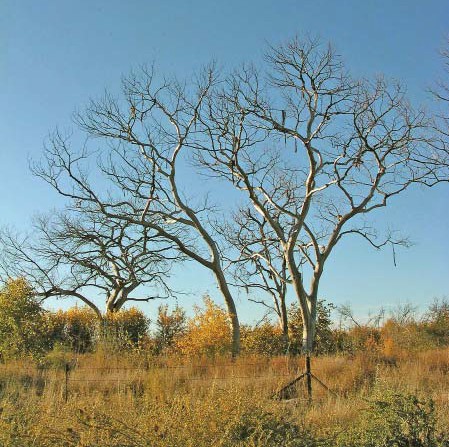
Two and a half years after the 2003 fire near the Bernardo/U.S. 60 bridge, the devastation was apparent. Photo by Mark B. Higgins.
The BLAS provides new guidelines for bosque management, which are being incorporated by numerous agencies actively working to reduce the potential for and the impact of fires in the bosque. One multi-agency restoration plan already underway, the Bosque Wildfire Project, involves the U.S. Army Corps of Engineers, the City of Albuquerque Open Space Division, the Middle Rio Grande Conservancy District, the Corrales Bosque Preserve, Village of Corrales, the Pueblo of Sandia, the Pueblo of Isleta, the New Mexico State Forestry Division and others. The project seeks to selectively thin areas with high fuel loads and/or non-native vegetation, to remove jetty jacks and debris, to improve emergency access (drain crossings, levee road improvements and construction of turn-arounds) and to revegetate burned and thinned areas. The project area includes the Albuquerque Reach of the Rio Grande bosque (also known as the Rio Grande Valley State Park), the Corrales Bosque Preserve and locations within the Pueblos of Sandia and Isleta. Similar work is being done by the Socorro Save Our Bosque Task Force for Socorro County, as well as at other sites along the valley.
One of the main strategies used now to prevent fires is the removal of non-native vegetation and dead and down woody debris from areas that have not burned. This involves large-scale removal of dead trees and fallen branches using heavy equipment such as brush cutters and Bobcats; the wood is typically either removed from the site and offered to the public as firewood or chipped and spread across the site in an attempt to restore nutrients to the forest. This fuel load reduction, however, has brought mixed reactions. While it appears that decreasing accumulations of woody debris on the forest floor and removing non-native shrubby plants will decrease the potential for devastating fires and help to protect native cottonwoods, this also removes habitat for certain native animals. In particular, there has been controversy over removing habitat for shrub- and ground-nesting birds. Studies have shown that overall bird species richness is enhanced by the presence of a variety of habitats within the bosque corridor—such as the presence of sand bars and meadows, thick brushy understory, mid-level shrubs, as well as mature trees. There has been concern that removing understory vegetation and woody debris will remove much of these available habitats. Some clearing is being done in stages over several years to allow native plants to get established in partially cleared areas before all non-native plants are removed. Certainly it is important that clearing is done during the non-breeding season to protect nesting birds. Clearing done during the breeding season causes nest abandonment and can directly kill birds. Revegetating with native shrubs will be important to maintain the shrub habitat needed by certain avian species.
One message concerning the bosque is clear from the recent increase in wildfires: a healthy bosque will not survive without active intervention and management and indeed without drastically new management practices. Perhaps ironically, what is needed are changes that approximate the structure and functioning of the old system—albeit within the spatial constraints of the present system—and a reduction of regulatory activities that impact the river's natural flow regime. We now know that we must take our lessons from the river itself and restore or rehabilitate what we have changed, in order to save this unique ecosystem.
Selected Bosque Fires
To best understand the effect of fire in the bosque, it is helpful to visit a burned site. The following is a summary of some recent and better known fires in the Middle Rio Grande Valley (information from the City of Albuquerque Open Space Division, the Middle Rio Grande Conservancy District and the Bosque del Apache National Wildlife Refuge). Look at the Bosque Education Guide web site for additional sites.
Montaño Fire
When: June 25, 2003
Where: Montaño Bridge at all quadrants. Source of fire was from the northwest section.
Size: 113 acres (46 ha).* The northwest quadrant burned 67 acres (27 ha). Started on public land and spread to private land.
Cause: Human-caused (cigarette)
Recovery work: Large burned trees were cut down and cut into firewood-size pieces. Most of the wood was made available to the public as free firewood. There was less chipping in this area compared to the I-40 fire (see below). Larger open areas were seeded with native grasses and cottonwoods were pole-planted. Exotic stump re-sprouts were sprayed with herbicide. Native stump re-sprouts were caged to protect against beavers. Open Space Division and students are monitoring on- going recovery.
I-40 (Atrisco) Fire
When: June 24, 2003
Where: On both sides of the river, mostly north of the I-40 bridge, to just south of Campbell Road (south of the Nature Center Discovery Pond)
Size: 150 acres (61 ha). Started on public land, spread to private land
Cause: Human-caused (fireworks)
Recovery work: Large burned trees were cut down and most of the wood was chipped and spread on the ground. Some larger pieces were offered to the public as firewood. Some cottonwood and willow poles were planted. Larger areas farther from the water table were seeded with native bosque grasses. Exotic re-sprouts from stumps were sprayed with herbicide while native re-sprouts were protected with beaver caging. Open Space Division and students are monitoring recovery.
La Orilla Burn
When: April 23, 2002
Where: West side of river between La Orilla and Paseo del Norte
Size: 35 acres (14 ha)
Cause: Human-caused (illegal campfire)
Recovery work: Burn recovery included 1,100 new trees and shrubs planted in the burn area. Replanting was a coordinated effort between the City Open Space Division, Tree New Mexico, schools and other volunteer groups.
San Pedro Fire
When: June 8, 1996
Where: Near the community of San Pedro, north of Bosque del Apache National Wildlife Refuge. The fire burned south and into the refuge.
Size: Approximately 6,000 acres (2,428 ha) total, with 1,640 acres (656 ha) within the Bosque del Apache National Wildlife Refuge
Cause: Human-caused (arson)
Recovery work: (This summary is based primarily on work done within the Refuge.) Recovery work includes extensive exotic control, using an excavator to remove root crowns with little soil damage, clearing with root plows and root rakes and treating sprouts with herbicides. Cross dikes and water delivery systems were added in some places to manage water levels and promote native tree germination. Refuge personnel, along with members of the Socorro Save Our Bosque Task Force, developed a conceptual plan for restoration of the whole valley (Socorro area), including San Pedro burn areas. Other procedures include monitoring physical and biological aspects of the system and removing some of the man-made infrastructure.
* ha = hectares, a metric unit of area equal to 10,000 square meters or 2.471 acres
A Glossary of Fire Terms
Canopy is the uppermost branches of trees forming a continuous cover of leaves at the top of a forest.
Crown fire is a high-severity fire that reaches up into the forest canopy.
Fire adaptation is a characteristic that enhances the ability of an organism to survive fires.
Fire break or fuel break is a natural or man-made barrier that lacks fuel sufficient to maintain a fire.
Fire dependence refers to natural communities that are adapted to fire and that rely on fire for maintaining conditions needed by plants and animals in those communities. Such a system may be called a fire-dependent ecosystem.
Fire ecology is a branch of ecology that studies the origins of wildland fire and its relationship to the ecosystem.
Fire history indicates how often fires occur in a given geographical location.
Fire-independent ecosystem is a system that does not have fires at all, either because there is no ignition source or due to a lack of vegetation.
Fire intensity is a measure of heat generated by a fire. This can only be measured during the fire, so typically fire severity (see below) is a more useful measure when making observations at a site after it has burned.
Fire regime reflects the characteristics of fire in a given ecosystem over time, such as the frequency, predictability, intensity and seasonality of fire. This is basically the role that fire plays in that ecosystem.
Fire scar is a mark on a tree produced by a layer of charcoal (a burned layer) that is then enveloped by a layer of new growth.
Fire-sensitive ecosystem is a system that evolved without the influence of repeated fires, in which the plants and animals generally lack adaptations to come back after fires.
Fire severity is a measure of the degree to which a fire alters a given site. Fire severity can be determined after a fire, based on characteristics such as the extent of burn (char) on a tree or the amount of leaf litter remaining on the ground, and this is used to estimate the effects of fire intensity.
Fire triangle indicates the three elements needed to start and maintain a fire: heat, fuel and oxygen.
Fuel ladder is dry or volatile plants of different heights that carry fire up to the tops of trees, such as fallen trees, branches or exotic plants (saltcedar, Russian olive).
Ground fire is a fire burning on the ground or through the understory and not reach- ing into the canopy.
Prescribed burn/prescribed fire is a fire intentionally set under known conditions of fuel, weather and topography to achieve a specific management goal.
Reclamation is the act or process of bringing wild or waste land into a condition for productive use, or repairing an area after activities such as mining or fire (typically modifying an area to be of some use to humans).
Restoration is the process of restoring an area to its natural condition (or a condition that mimics the natural condition as nearly as possible).
Topography is the surface features of a place, the contours of a landscape large or small.
Wildfire is a non-structural fire (not in a building), other than a prescribed fire, that occurs in a forest or other wildland area.
Wildland–urban interface is land close to or within forested area that contains houses and other buildings.
References
Bosque Landscape Alteration Strategy Objectives, Basic Requirements and Guidelines. 2005. Yasmeen Najmi, Sterling Grogan and Cliff Crawford. Middle Rio Grande Conservancy District, Albuquerque, NM.
Resources
The Corps of Engineers has a web site with maps of burned areas. The New Mexico State Forestry Division maintains a list of bosque fires at emnrd.state.nm.us.
Chapter 6 Downloads and Activities
Activities
Chapter 7: Living Like We Love It
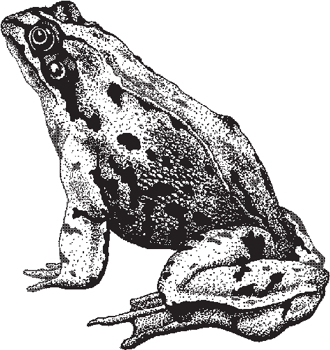
Living Like We Love It
Service Learning and Outreach
This chapter explores the potential of making the bosque a focal point for service-learning opportunities. This chapter is intended to guide teachers toward helping their students participate in improving the bosque ecosystem. Research shows that when environmental education involves students in action efforts the students develop increased knowledge. Your students will also be empowered by the opportunity to help the bosque. This chapter is divided into two sections; the first provides information on traditional service-learning projects that include taking action in the woods, and the second section suggests ways students can share their knowledge of the bosque with other people.
Service Learning in the Bosque
An important step in effective environmental education is to encourage students to take action based on their newly acquired knowledge. As they learn about the bosque through field trip and classroom activities in this guide, students develop the idea that the present-day bosque needs human assistance to maintain ecological health. Involving students in a service-learning project in the bosque empowers students by allowing them to make a difference.
Service learning is a teaching method that engages students in service activities that are integrated into an academic curriculum. Students use academic skills they are learning in the classroom to conduct service projects, to meet actual community needs. Providing students with real-world applications for their academic skills allows them to recognize the value of what they are learning and increase their retention levels. The concept of using service as a tool for teaching required academic skills is what differentiates service learning from community service; the latter focuses exclusively on volunteerism. (In addition, the term "community service" has, in recent years, often been tied to court-mandated restitution for crimes.) Service-learning projects are carefully designed with student learning in mind, and are not merely cheap student labor. With service learning a sense of responsibility and caring is fostered by connections forged between students and the community, plus students are empowered by the ability to create positive change. Recent studies have shown that by increasing students' confidence and responsibility, service learning helps reduce truancy, dropout rates, violence, and apathy.
Each service-learning project consists of four essential steps: 1) preparation; 2) implementation; 3) reflection; and 4) celebration. Preparation and planning are required to determine what type of service should be done and how it fits into the curriculum. More planning and revision will occur during the implementation phase because a real project is never identical to a written plan. Reflection activities such as discussion, journal writing, and artwork are important for students to process what they have learned and experienced. Projects culminate with a celebration to honor the students' accomplishments. (Adapted from Service Learning in the Albuquerque Public Schools, Center for Service Learning, Montgomery Complex, 1998–1999.)
By involving students in action projects to preserve, sustain, and enhance the bosque (and its associated watersheds), our children, who are the future adult citizens, develop a sense of ownership and stewardship of the local environment. Another type of service-learning activity is for students to reach out to others to educate them about the bosque. This chapter is divided into two sections: on-the-ground projects and outreach projects. Additional information to support these sections can be found in the Resources for Bosque Education handout available at the Bosque Education Guide workshop.
On-the-Ground Service-Learning Projects
The bosque and the river itself are very important features in our ecosystem and therefore provide an ideal setting for service-learning projects. Any type of environmental topics can be related to bosque projects. Natural history and human impact on the river and bosque can be discussed through a variety of projects from a trash cleanup to pole planting.
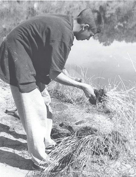
The Rio Grande Nature Center State Park was the site of a service-learning project for Rio Grande High School students, including Alfonso Amaro, in 2000.
Service-learning projects, including activities as simple as trash cleanup, need to be coordinated with the appropriate local agency personnel. With service-learning projects, there are specific roles for students, teachers, and agency personnel. Students need background information about the problem and the project that is addressing the problem. Ideally, students develop this knowledge through active participation in the planning of the work project. If students have not been involved in the project plan, they need to be briefed in advance of the workday so they will know what they will be doing and why. Teachers need to form a partnership with the agency personnel they are working with to set up clear communications about goals and procedures. Teachers need to explain to agency personnel how the project ties in with student curriculum. Agency personnel should try to balance the needs of the teacher and the students with the needs of the agency. It may be useful for agency personnel to visit with students in their classroom to discuss the project prior to the work day.
There is no one right way to develop a service-learning project. Sometimes a project evolves from students identifying a problem, developing a solution, and then working with the agencies to implement that solution. More often, students or teachers contact the agencies to see if they have a project that they would like help implementing. There are several ways that students can assist with bosque projects. Below is a list and short descriptions of some of the more common bosque service-learning projects. Students and teachers should get specific instructions for implementing these projects from the agency personnel.
- Pole planting
- A method of reestablishing cottonwood trees by placing cut cottonwood poles or saplings (grown for this purpose) in the ground water. Projects take place during the late winter months (generally February to April) prior to tree buds leafing out. As adequate supervision is essential for tree survival, these projects are generally limited to smaller groups of students.
- Trash cleanup
- Essential to keeping the bosque clean and safe. Safety is essential in this activity (see guidelines under Safety). This is a relatively simple activity to plan and execute and is recommended for large groups of any age including younger students.
- Seed ball making and distribution
- One method of disseminating grass and herb seeds into an area. This is an excellent activity for teaching about the importance of native plants. Seeds are mixed with mud and made into mud balls, which is a totally enjoyable activity, especially for younger students. Once the mud balls harden, they are distributed in areas where native seed sources are lacking and yet native plants are desired.
- Reseeding large areas with grass and wildflower seed
- Another way to reintroduce native plants into an area where natural seed sources are marginal, such as sites of catastrophic fires. This activity is generally suitable for medium-size groups (large groups if there is adequate supervision) of any age group.
- Fuel-wood removal of dead limbs on the ground
- Involves moving logs and limbs out of the bosque. If left in the bosque, these materials make wildfires burn hotter and longer, which may cause more catastrophic fire damage. Students can expand the scope of the project by delivering this excess fuel as firewood to elderly or disabled people. This project needs close supervision, especially if students will be using handsaws to cut material in manageable pieces. It is an ideal project for small groups of middle school and/or high school students.
- Fuel-wood removal by chipping brush
- Another method of lessening the risk of catastrophic wildfires. Chipping keeps the material on the site (including nutrients tied up in the woody material) and creates mulch. The chips lie directly on the ground and therefore do not burn as easily as limbs that have access to ample oxygen. Chips are also smaller and therefore would not burn as long, and they decompose faster. Students should not feed the chipping machine (this is best done by an agency employee), but would scavenge and bring materials to the chipper. Supervision around this type of equipment is a must, and older, more responsible students are better suited for this job.
- Trail clearing, construction and maintenance
- Can involve students in minor or major projects, keeping a trail system accessible in the bosque. Generally these projects are good for small groups of middle school to high school students. Adequate supervision by teachers and parents is necessary.
- Jetty jack removal
- Another project for the older, more responsible students. This must be highly coordinated with many agencies, and provides a wonderful opportunity for students to learn on many levels, including the scientific reasons for removing jetty jacks, the governmental entities that are involved, and the technical skills to work with metal structures.
This list is not intended to be complete. Encourage your students to think of ways that they can help the bosque and facilitate their journey in building support for their project and getting cooperation from the necessary agencies.
Each project has technical guidelines for completing the project successfully. Students need to rely on the appropriate agency contact to provide direction for each project.
Preparation for a Service-Learning Project
The project will be more meaningful to the students if they understand ahead of time why their work is important. Many of the activities in this guide are excellent introductions to these projects and should be done before the scheduled project day. For example, before having students plant cottonwood poles, introduce them to the concept with the activity "How Deep is the Water Table?" in Chapter 5. The activities in Chapter 4 are an excellent background for many bosque restoration projects.
Where it is practical, get the students involved in planning the project. Most agency representatives are happy to talk with students about proposed service-learning ideas.
For the project itself, students need to have the right equipment and materials: work clothes, work or hiking boots, water, sunscreen, food, work gloves, etc.
Parents and chaperones need to be briefed on what the project is and what to expect. Teachers and parents acting as chaperones should also participate in the project and will be expected to monitor the students for safety and quality of work.
Factors influencing the type of project available may include age of the students, class size, adult supervision and time of year.
Implementation of a Service-Learning Project
Safety is the highest concern for all projects. Students should dress appropriately for outdoor work: work clothes, work or hiking boots, work gloves, etc. Each student's parent(s) must sign a liability waiver prior to student involvement in these activities, and teachers/administration should have a copy on file for the school year.
Any project should begin with a safety discussion that should include:
- Tool safety
- Introduction to the types of tools being used, proper use, hazards associated with those tools. All participants should wear work gloves at all times.
- Area hazards
- A discussion of the hazards that are particular to the bosque should include the river itself, jetty jacks, Russian olives and other thorny plants, and transient camps. Students should be advised to stay together and not wander off on their own.
- Weather hazards
- Whether hot or cold, appropriate clothing is necessary; have plenty of drinking water available.
- Trash hazards
- Warn students to use care when picking up glass and rusty metal; use care and teamwork when removing large or heavy objects; make sure everyone knows what a hypodermic needle is and warn them not to touch them (agency staff should be notified of needle locations).
- Fuel-wood removal hazards
- These projects may involve students working around dangerous equipment such as chippers or chainsaws. Never allow students to operate such equipment, and students should not be in an area where trees are being felled. (Chainsaws should only be used near students for "bucking" material.) Students may participate in various aspects of fuel-wood removal as a follow-up to work started by agency staff. Agency personnel will be responsible for cutting the trees and brush. Students may participate by carrying dead and down wood out of the bosque and making it available to the public. Older students may participate in chipping the brush and smaller branches left from the removal of exotic trees or smaller dead and down materials.
Safety is a major concern during fuel-wood removal projects, and adult supervision by teachers and parents is necessary.
Reflection on a Service-Learning Project
Reflection is a critical component of a successful service-learning experience. Your students should engage in reflective activities before, during, and after a service-learning project. Your goal as an educator is to help your students connect concepts learned in the classroom to service activities experienced during a bosque project.
An essential component to any service-learning project is structuring time for students to engage in reflective activities before, during and after their project (in the classroom and in the field). Some activities lend themselves to individual work; for other activities, student learning can be enhanced by working in teams. Teachers can ask students to: write in a personal journal (using prompt questions—see sidebar—to guide their responses); engage in small-group discussion or whole-class discussion; use art work (posters, murals) and photography; write articles for the school newspaper; write a final project report; make a presentation before a school assembly.
The goal of reflection in service learning is to ensure students make connections between the concepts presented in the classroom and their work to improve the bosque through their service project. By engaging in reflective activities, they are developing their own critical thinking skills. Ultimately the goal is to help students become environmentally literate lifelong learners and actively involved citizens.
Prompt Questions for Service-Learning Activities
(Adapted from Project Learning Tree Green Works! Connecting Community Action and Service Learning, 2001)
Students should be asked to "process" their experiences by considering and responding to a series of questions.
Here are some examples:
What was the goal of your project? What were its objectives?Did you accomplish your goals and objectives? What was the most successful part of your project? What was the least successful part of your project? Who was influenced or motivated by your actions?
If you repeated the project, what, if anything, would you do differently? How do you feel about your involvement in the project?
Have your feelings and opinions about the issue you worked on changed since you began the project?
What did you learn during this project that you will be able to apply to other situations?
Would you get involved in another environmental action project? Why or why not?
What advice would you give to other students who are planning an action project?
Do you think it is important for citizens to volunteer for community service? Why or why not?
Celebration of a Service-Learning Project
Celebrations are important events in children's development. They are often markers of success. When we choose to take the time to celebrate an event, we are acknowledging the importance of that event for our students. Therefore, the final step of a service-learning project, celebration, should not be overlooked.
Set aside a special time at the conclusion of their project for students, teachers, agency personnel and parents to recognize and celebrate their successful accomplishments. Students can write and read short essays to the gathering and share with each other how they have benefited from the experience. Perhaps the students will want to generate a short poem about the event, such as haiku that can be put on thank-you notes and certificates of appreciation.
The celebration step can also be a good opportunity for all participants, students, parents and agency personnel to provide feedback on the project. This might involve writing out a list of what works and what does not work for the next group of students. For example, the Bosque Ecosystem Monitoring Program (BEMP) holds a student congress towards the end of the school year for students from several schools who have all been participating through the year in the program. One activity at this congress divides the students into teams mixing participants from the different schools. Each team is given the cut-out of a poster-board size tree trunk and many "cottonwood" leaves cut out of construction paper. In groups, these students write advice to next year's students about the program on the paper leaves. Some comments include practical advice like "drink lots of water" or "wear long pants." Other comments demonstrate a knowledge of the program: "write down your data as soon as you take it," "write legibly," "don't use plastic bags for leaf samples," etc. Still other comments show deeper reflection: "take care of the bosque—it is beautiful, remember that people are counting on your work—so be very conscientious." Once these comments are glued to the tree branches, each participating teacher is given a poster to take back to his or her classroom to use as an orientation tool for the next year's students.
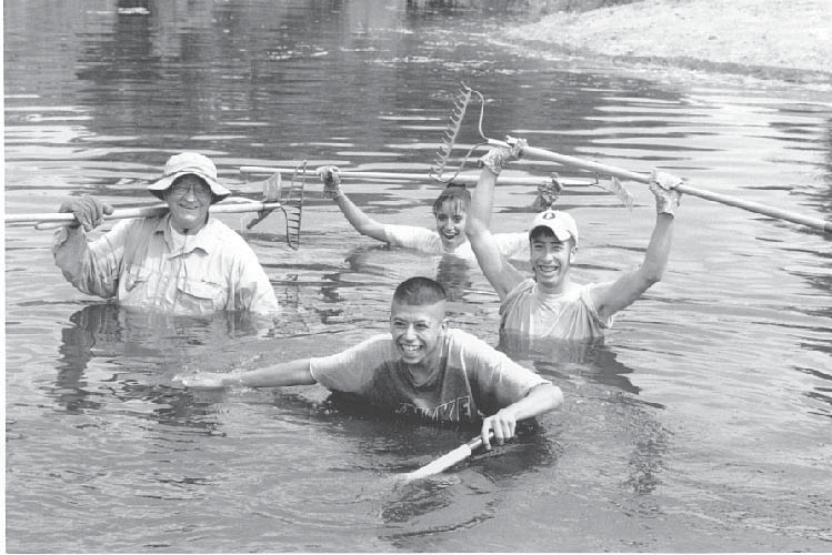
Having a good time at the Nature Center are (clockwise from left) volunteer Jerry Schuder and RGHS students Irene Chavez, Vincente Telles and Alfonso Amaro.
Thank-you notes and/or certificates should be a part of the celebration process. These can be generated or awarded at the event. Certificates of appreciation or participation could be given from the agency to the students. The students can award certificates of thanks to recognize parents and sponsors who have contributed time, energy and funds. Agency personnel should be recognized and thanked for their involvement and support.
No celebration is complete without food. Serve pizza or ice cream or have students plan the menu! This might be a good time to serve cake. In Chapter 4, Changing River, an assessment idea is to have students decorate three cakes showing the components of the modeling activity for Rio Bravo, Rio Manso, and Rio Nuevo. This activity might be an excellent opportunity to prepare snacks for the service-learning celebration.
Finally, make sure the event is fun. Sing songs. Play games. Have a good time.
Outreach-Oriented Service Learning
Not all service-learning projects will follow the classic model described above of students going to the bosque to perform a specific task. In fact, many projects are ongoing or include doing outreach about the bosque. This section is included to go more in-depth with examples of existing programs and ideas for sharing bosque knowledge with other audiences. Here is a quick look at some past or existing service-learning projects in the bosque or on the river.
Bosque Ecosystem Monitoring Project (BEMP)
Co-sponsored by the UNM Department of Biology and Bosque School, a private independent school in Albuquerque, the Bosque Ecosystem Monitoring Program (BEMP) collects long-term monitoring data on many parts of the bosque ecosystem. For the most part, students from many participating schools collect data on a monthly basis. Sites extend from San Juan Pueblo north of Española to Socorro. Students collect monthly biomass samples, weather information, and ground water data. Other data collected during the year includes information on plants and insects. Many of the participating classes use the BEMP program as the core of their science teaching.
Alameda/Rio Grande Wetland (COA, Open Space Division)
Constructed at the Alameda/Rio Grande Open Space property, which was jointly purchased by Bernalillo County and the City of Albuquerque, Open Space Division (OSD), the Alameda/Rio Grande Wetland is a five-acre wetland (3.5 surface water acres). Volunteers, including many classes involved in service learning, have assisted with much of the development and maintenance of this site. In October 1998, the wetland construction was completed and a liner was installed. The liner consists of a vegetable emulsion mixed with clay-like soil. The pond was filled with water from the irrigation ditch. Wetland and upland plants were planted in and around the wetland and on the island. Water levels are monitored and replenished when needed. Floating duck nests were installed for resident wildlife. A pair of geese had six goslings during the 1999 nesting season while nesting in the irrigation ditch bank. Hopes are to foster additional use by wildlife and allow plants to flourish and provide a haven for its non-human users. Water quality is being monitored monthly and guided tours are given at the project.
Albuquerque Overbank Project
The Albuquerque Overbank Project (AOP) is a collaborative effort between OSD, the Bureau of Reclamation (BOR), the Middle Rio Grande Conservancy District (MRGCD), University of New Mexico, New Mexico Natural Heritage Program, the Army Corps of Engineers, and the U.S. Fish and Wildlife Service. A site in the south end of the Rio Grande Valley State Park was chosen to prepare for overbank flooding. In February 1998 the BOR removed Russian olive trees that covered approximately three acres along the bank of the Rio Grande. Removing soil, which was put on top of a sand bar that was too low to maintain cottonwood seedlings, then lowered this bank. During high flows in the spring the area was flooded. After two seasons of flooding, some cottonwood seedlings were three to five feet tall and are now 15 feet tall. The project is being monitored for vegetation, hydrology and water chemistry. The project has yielded over 400 cottonwood seedlings by creating an area where the river can again overbank flood.
Bosque Restoration Demonstration Project
The Bosque Restoration Demonstration Project is a five-acre site on the east side of the river between Central Avenue and Bridge Blvd., along Tingley Drive. Rio Grande Restoration, OSD, and Rio Grande Nature Center have joined together, with the support of the Board of Directors of the MRGCD, to raise public awareness about fire dangers and to demonstrate the importance of bosque restoration. Five acres were cleared of dead material and non-native species to show visitors a restored and unrestored bosque for comparison. Volunteers planted cottonwood and willow trees. A loop trail guides people through the area and pauses at a river viewing area built by an Eagle Scout. Understory planting, educational sign installation, and additional restoration are planned for 2002. Contact organizations include Rio Grande Restoration and Albuquerque Open Space Division.
Dia del Rio
Each year in October, thousands of citizens from the headwaters of the Rio Grande in Colorado to its journey's end at the Gulf of Mexico on both sides of the U.S.–Mexico border dedicate a day to the Rio Grande. The Dia del Rio celebrates the Rio Grande/Rio Bravo, the nation's fifth-largest river. Dia del Rio is a nonprofit event run by volunteers. The Rio Grande/Rio Bravo Basin Coalition sponsors this event throughout the Rio Grande.
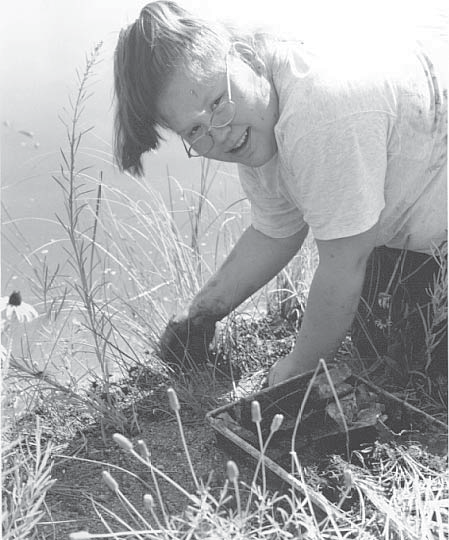
Watershed Watch Program
High school and middle school teachers can contact the N.M. Department of Game and Fish about this four-part riparian assessment program on stream channel conditions, stream hydrology, plant species and structural diversity, and macroinvertebrate survey.
Outreach Ideas
Another aspect to service learning is to encourage students to share their knowledge and interest in the bosque with others. There are many ways to accomplish this goal. Students have performed plays or music events with a bosque theme for relatives and friends. Classes have hosted other classes in bosque tours. Other events might include visits to nursing homes, other schools or classrooms, or government agencies. Service-learning activities might also include letter writing and visits to governing bodies to present concerns.
For more information on service learning see the annotated bibliography in Appendix B. A list of contact agencies and representatives is available as a workshop handout.
Bosque Education Guide Appendices
Appendices
Some appendices have been added as webpages, and some are available for download as a PDF.
- Appendix A: Glossary (PDF)
- Appendix B: Annotated References (PDF)
- Appendix C: Supplemental Activities (PDF)
- Appendix D: Human Chronology (PDF)
- Appendix E: Arthropods (PDF)
- Appendix F: Vertebrates (PDF)
- Appendix G: Plants (PDF)
- Appendix H: Dichotomous Plant Key (PDF)
- Appendix I: Activities by Grade (PDF)
- Appendix J: Activities by Topic (PDF)
- Appendix K: Standards Correlation (PDF)
Visit
Get tickets and plan your next visit.
Exhibitions
Explore New Mexico’s natural and scientific wonders.
Learn
Dig deeper with programs and resources for all ages.
Research & Collections
Learn more about the science that powers our museum.
Get Involved
Become a part of our community.